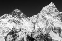
The format of this guide differs slightly from the others. This guide is partly a journal of the author's experience in Nepal. Highlights covered in this guide include the capital city of Katmandu, Royal Chitwan National Park, and a hike to near Everest Base Camp, on a 18,200 foot mountain called Kala Patar. Nepal is a country that I will never forget. It is the land of the rising mountains, mountains that rise so high, you can not imagine … [Read more...]
Nepal – Travel Facts
All foreign nationals except citizens of India need visas. Single entry visas are issued for up to 30 days. However, they can be extended for up to 3 months. Trekking permits on the other hand are needed if you plan on hiking in the Himalayas. These permits can be obtained from immigration offices in Katmandu. The time zone is GMT/UTC plus five hours and 45 minutes. Electricity is 220 volts. Weights and measures are in the metric system. The … [Read more...]
Nepal – Helicopter Flight
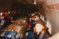
From Katmandu we took an old Russian military helicopter to our base hiking elevation of 9000 feet, in a small town called Lucla. I am glad that we took a helicopter because the runway in this town begins on the edge of a steep cliff, with nothing but hundreds of feet of air between you and the bottom of the ravine. At the time of our trip this runway as gravel at best (since paved) and is situated on a fairly steep slope. The runway is steep … [Read more...]
Nepal – Porters
Once you reach Lucla and step out of your plane or helicopter you will be greeted by many people, mostly porters. The porters will surround you and ask if you need some help in carrying your packs. Porters can be hired for a few American dollars per day. Sometimes they will request that you pay for their dinner at one of the many lodges scattered along the trail. I was surprised to see that the porters were quite short and wiry. I was also … [Read more...]
Nepal – Medical Kit
The medical kit is an essential part of what you or your porter carries on the trail. Some of these items may be much appreciated when you are feeling terrible on the trail. For more information on what to take for altitude sickness, the correct milligrams, and other medications consult your physician. See the Sanitation section for more information. Some of the minimal items are listed below: Water disinfectant: Iodine … [Read more...]
Nepal – What to Bring
Besides the medication and medical kit there is quite a bit that the trekker can bring. If you are going to hire a porter, put what you can into your bag and worry less about the weight. If you are going to carry your own pack you must prioritize what is really important to you on backpacking trips, and consider weight as a factor. If you are not planning on backpacking this list will still help you in your packing. Some of these items may be … [Read more...]
Nepal – Food
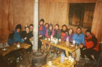
This was the important part of the trip for me. I like to eat! However by the end of the trek I could barely stand the sight much less the taste of the Nepali Himalayan food. First of all let me describe how the food is cooked and the process of a hungry tourist trying to get food. After a long day hiking on the trail you arrive at the lodge, more often then not, in the dark. There will be a few tourists or maybe none at all depending on the … [Read more...]
Nepal – Itinerary
The following is an itinerary for our hike from Lucla to the top of Kala Patar. The time allowed for this hike was a bit short. An extra day or two would help some people better acclimatize to the high altitude. General Day 1 Fly into Lucla (9,100 ft). Get porters and start hiking up the trail. From Lucla it is a 2.5 hour hike to Pakding at 8,600 ft. From Pakding it is a 2 hour hike to Mondzo at 9,300 ft. Then from Mondzo it is an hour … [Read more...]
Nepal – The Trek
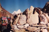
This is a short story about a 12 day trek I took in the Himalayas. This was the trip that turned me on to International travel and was the direct inspiration for starting Dave’s Travel Corner, i.e., this website. Sometimes people speak of “a trip of a lifetime” – for me, Nepal was that trip. Be prepared to read – this is a long one! We were delayed in the Katmandu airport for some reason. Our guide speculated that someone had paid more money … [Read more...]
Nepal – Trekking Companies
Trekking differs from just a "hike" in that trekking is partly a cultural experience. While on the trail not only are you experiencing fantastic views of awesome scenery, but you are interacting with porters, meeting people from around the world who have come to hike in the Himalayas, as well as meeting the Sherpa people. Trekking can either be organized through established trekking companies or done solo. Expect to pay more for trekking … [Read more...]


