It’s easy to argue that California is the land freeways and automobiles. And with its massive scale and incredible geographic diversity, there are plenty of scenic routes to explore. We’ve all heard of the world-famous drives, like the section of the Pacific Coast Highway through Big Sur or Mulholland Drive through the Hollywood Hills. While I have plenty of favorites, I’d like to share three lesser-known routes. There are, of course, many more that I don’t have room to list or, more likely, don’t even know about yet. So with apologies to those drives left out or as yet unexplored, let’s hit the road:
Carmel Valley Road, from Carmel to the Ventana Wilderness
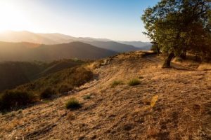
County Road G16, also known as Carmel Valley Road, starts on the coast in famed Carmel, very close to the historic Carmel mission, and heads east toward the Ventana Wilderness. While the first few miles pass through towns, the road quickly becomes more secluded and rural. Villages give way to individual farmsteads and vineyards, and eventually just meadows and pastures. The ever-present California Live Oak dots the rolling hills, providing that quintessential rural California feeling. Pretty soon, all other traffic seems to disappear – only the occasional cyclist or local rancher may pass by. I love to stop the car randomly (without even bothering to pull off to the side), turn off the engine and just enjoy the sound of the wind rustling through the trees. It’s not unusual for a random cow or a herd of sheep to break the silence. Or perhaps a family of California quail to stroll by.
Continuing on, the road passes by the eastern edge of the Ventana Wilderness, an uninhabited land mostly forgotten but scenic and beautiful beyond description. Random roads jut from G16 into the mountains to lead you to hiking trails into the wild backcountry. A few campgrounds are also available. Arroyo Seco is easily accessible and has plenty of facilities, while historic China Camp is much more remote and primitive. Route G16 ultimately leads to the town of Greenfield, right along the farmlands that line Highway 101.
PCH and the Lost Coast
Highway 1, also known as Pacific Coast Highway (PCH), winds its way 1,054 km (655 miles) along the California coast, from the San Clemente in the south all the way to Legget in the far north. In doing so, it hugs an astonishing 78% of the state’s extensive coastline. It is world-famous for a reason, and perhaps no portion more so than the Big Sur section (though the folks in Malibu might like to challenge that claim.) The truth is, it’s hard to point to just one portion of the drive as ‘the best’ part.
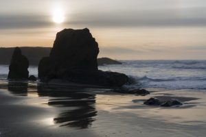
For the sake of this post, I’ll focus on a small northern stretch from Cloverdale to Shelter Cove. (Fair warning: if you get car sick or can’t handle dramatic cliff-hugging roads, skip this entire drive.) Getting from Cloverdale to PCH requires a couple of hours of driving on Route 128 through rural hill country and then dense redwood forest – a beautiful drive in its own right. Once on PCH, head north along the winding coastline through groves of giant redwood trees, narrow gulches and dramatic cliffside drives for some of the most breath-taking scenery California has to offer. At one point north of Rockport, the road turns sharply inward to detour around ‘the Lost Coast’ – a stretch so wild and rugged that it was deemed too difficult to build a road through. Instead, after going through an extremely windy drive through the forest, you’ll end up connecting back to Highway 101. My recommendation is to keep driving until Garberville, then head back west to the coast along the mountain road toward the hamlet of Shelter Cove, where a small restaurant awaits you. This is literally the only road through the entire Lost Coast region. With the exception of tiny Shelter Cove, there is no development in this stretch of land. Simply glorious!
Maricopa Highway
If you’ve ever driven through the Tejon Pass on Interstate 5 (known as “the grapevine”) north of Los Angeles, you get a hint of how beautiful the Los Padres National Forest is. And if you’ve been misfortunate enough to get stuck in one of the notorious traffic jams that plague this route, I highly recommend Route 33, also known as the Maricopa Highway. Granted, you’re going to make a giant detour that won’t save you much time and will end up taking you to Ventura, but at least you’re moving through some marvelous scenery instead of taking in heaping doses of diesel fumes from all the tractor-trailers. That’s how I ended up discovering this route. And since I had time to spare, it was well worth the side trip.
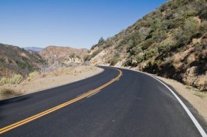
Maricopa Highway, though popular among motorcyclists and car enthusiasts, is one of the least traveled county roads in the state. It passes through the sparsely populated Los Padres National Forest, winding among hills and mountains, valleys and narrows. It alternates between long, straight stretches of open road to sharp hairpin turns along steep hillsides. Lots of frequent turnouts allow you to pull over and take in the grand vistas. Eventually, the road drops significantly in elevation, bottoming out in gorgeous Wheeler Gorge. On the far end of Maricopa Highway, you can top off your gas tank (and your thirst for fine local wine) in Ojai, relishing the fact that you just avoided the masses of big rigs and unhappy vacationers through the Tejon Pass. La belle vie!
When in Rome
If you are to do as the Romans when in Rome, then you should do as the Californians when in California. That usually means either eating In-n-Out or driving somewhere (or both!) So if you have the chance, try out one of these scenic routes. See you on the road.




Thank you for sharing some of your favorite ‘secret’ california roads – some of my favorite roads in california are highway 89 north of lake tahoe, running hot for many many miles with the top rolled down to hank williams jr blasting, a country boy can survive.
also south of lake tahoe heading down to markleyville with suzy boggus blasting Aces as loud as car stereo will allow for
I love driving painted cave road north of santa barbara, drove that sucker with a loaded 45′ one time. that bentley dad sent with me , packing heat
Highway 36 clicking fast east of red bluff to mt lassen, quintessential me and the road time
Angeles highway outta La Canada Flintridge – blasting What if by Kane Brown
one of my absolute favs is the 58 running from santa margarita north of slo past carizzo plains out to mckitrick – run that sucker hot as hell, almost get airborn on the oversize bumps
i love the high mountain road in the white mountains, stretch of pavement at nearly 12k absl – almost died climbing that mountain in frigid chill at midnight
Nice! I was debating as to whether or not to add Route 88 through Carson Pass to my list above but decided that would be a good one for another post someday.