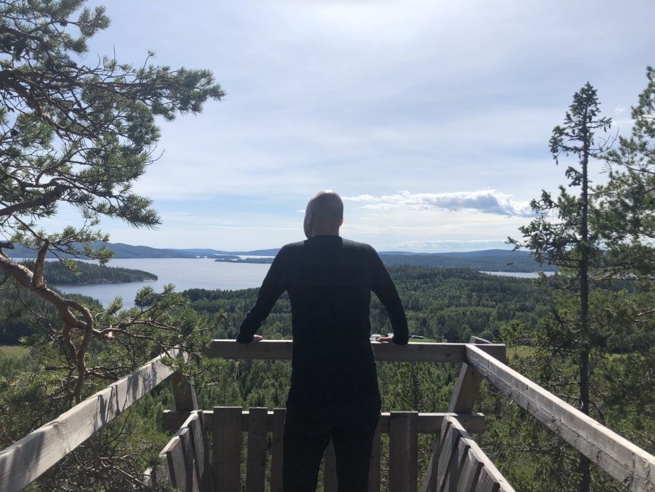
Here I am, overlooking a part of the beautiful High Coast of Sweden. The lovely view is thanks to a geological phenomenon where some parts of this area started rising as the heavy Ice Age glaciers melted away.
The High Coast, or “Höga Kusten” in Swedish, is a unique stretch of coastline located in the northeast of Sweden, and the water you see in the distance is the Gulf of Bothnia, a northern extension of the Baltic Sea.
The remarkable landscape has been shaped by what is called “post-glacial rebound”. This occurs when the Earth’s crust, compressed by the weight of Ice Age glaciers, rises as the ice melts. The High Coast has experienced a land uplift of approximately 800 meters since the last ice age. This continuous geological process causes the coastline to change and evolve, with new islands and inlets forming over time. Due to these distinctive geological features, the High Coast has been designated a UNESCO World Heritage Site.
Today, the area is beloved by both nature enthusiasts and adventure seekers. There are many opportunities for outdoor activities, and my girlfriend and I decided to go here for a specific reason: to challenge ourselves and hike the entire High Coast Trail.
Hiking in Sweden
Sweden is a surprisingly large country, the fifth-largest in Europe, with a relatively small population of 10 million people. Almost 90% of the population lives on the bottom half of its long shape, and so do we. This is a bit embarrassing, but before this trip, we had barely been on the top half.
Anyways, Sweden is one of the world’s best nature destinations with more forests than you can ever explore, well-protected nature in general, public access to almost all natural sites, great well-marked hiking trails, good public transport options to many national parks, and last but not least, an almost complete lack of animals that can harm you. Even the bears are the shyest in the world. So just avoid getting between them and their cubs. The same rule goes for the moose. And bring some mosquito repellant!
Hiking the High Coast Trail
The High Coast Trail, known as “Höga Kustenleden” in Swedish, is a 130km path that takes you through the heart of the High Coast’s landscape. It is divided into seven sections and stretches from the High Coast bridge outside the town of Härnösand in the south to the city of Örnsköldsvik in the north.
Towards the end, you will reach the main event, Skuleskogen National Park. Skuleskogen is an extraordinary place with its deep forests, dramatic crevices, and straight rock walls. It is currently ranked as one of the best places to visit by travelers from around the world.
My girlfriend and I hiked the entire 130km trail, and we are comfortable hikers, so we planned it out so that we arrived at a hotel or bed and breakfast every afternoon. This means that we did not need to carry a tent or too much food.
The trail is so well-marked that you will be okay even when going on autopilot at the end of the day; I can’t remember getting lost anywhere.
We started the adventure by taking a night train from our hometown, Gothenburg, on the Swedish west coast to Härnösand.
Section 1: Hornöberget – Lövvik (11km)
The trail starts at the foot of the High Coast Bridge, so we decided to stay a night at Hotell Höga Kusten, just steps away. The bridge is actually quite beautiful, and you get a good feeling for its size as you walk under it to reach the starting point of the trail.
We noticed that more and more of our trips started having at least a hiking component, but we don’t yet consider ourselves very experienced hikers.
After being a bit overly ambitious on a previous hike, we decided to keep things easy on the first day and just hiked the 11km section to arrive at Lövvik Bed and Breakfast, where we had reserved a cute cottage.
Section 2: Lövvik – Gavik (24km)
We woke up well-rested in our cabin and enjoyed a nice breakfast. Then, we headed out on a bit longer hike, which took us deep into the surrounding forests, and the layered plants in the above photo made it feel a bit fairytale-esque.
We did not complete this entire section as the day’s goal was to reach the cabin waiting for us at Hörsångs Camping, where my girlfriend beat me at miniature golf. It’s a very run-down miniature golf course (not that I can blame the loss on that – or can I?), but otherwise, it’s a nice place with a small beach.
Section 3: Gavik – Lappudden (9km)
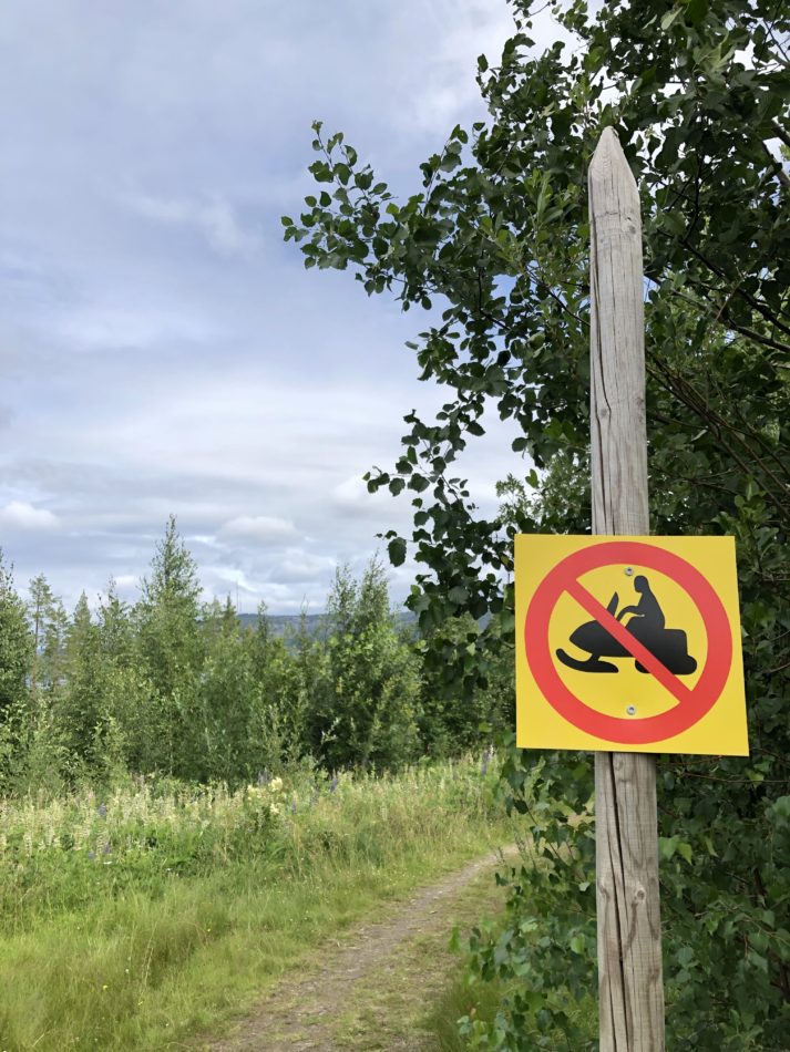
Section 3 was a bit heavy on the mosquitos but very light on snowmobiles. There were a lot of lovely views with little sand and cobble beaches where we rested and snacked on the power bars that we always keep handy. We arrived at Lappuddens Friluftscenter in good moods, and its fantastic setting on a small peninsula did not disappoint.
Section 4: Lappudden – Ullånger (15km)
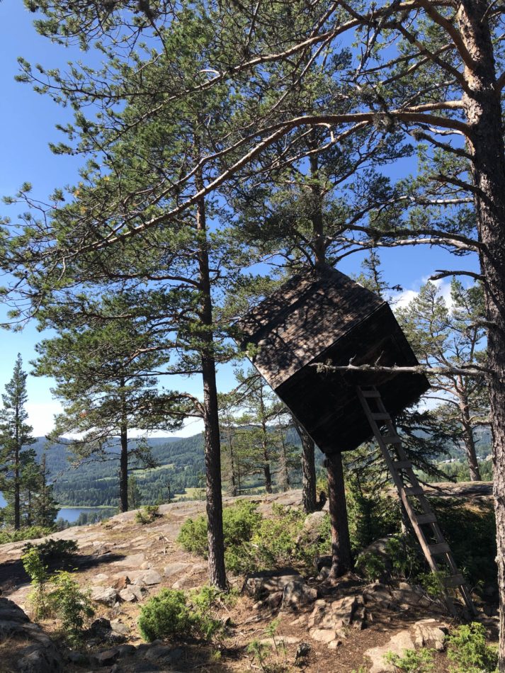
This section not only had more dramatic views thanks to gaining some altitude, but it was also rather special thanks to the remnants of ARKNAT, an architectural festival. Every year, architecture students from all over Scandinavia meet and build beautifully designed shelters in nature, and let me tell you, they make some amazing things! The tree cube in the photo was just one of a handful of wooden structures scattered in the landscape on a mountain ridge. I loved this mix of sustainable design and spectacular nature.
We arrived at Hotell Ullånger feeling like we had experienced something special.
Section 5: Ullånger – Skuleberget (21km)
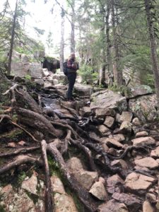
Until now, the actual hiking had been fairly easy, even if we went to bed with tired legs every evening. But this section was a challenge for both body and mind. There was the sheer distance, but there were also several of these large areas where solid ground gave way to round rocks that moved as we stumbled across them. It made for a great-looking landscape and very sore legs. Luckily, we had planned a two-night stop at Docksta Hotell, which, judging by the cost, should be somewhat luxurious.
Docksta Hotell was not luxurious. And Docksta was one of the worst places I have ever visited in Sweden. I can’t think of anything good to say about it. There is a highway running straight through town. We ate at all the restaurants without having a decent meal during the whole stay, and the whole place just felt off. We were more than happy to leave, especially as we knew what was coming up.
Section 6: Skuleberget – Köpmanholmen (24km)
Finally, it’s time for Skuleskogen! The amazing-looking place that made us book the trip in the first place.
This national park is not always an easy hike (or should I call it a climb), even as you move along the marked paths, but that makes it more fun. You get deep green forests, mountain walls divided by the force of nature, and mile-wide ocean views. Hard to beat! The only downside is that it can get pretty crowded along the main paths, but we did not mind. I felt like I was right in the middle of some of the old Swedish children’s stories from my childhood. Trolls, witches, and giants!
We stayed at the modest Nätra Motell and celebrated our milestone with a dinner in town.
Section 7: Köpmanholmen – Örnsköldsvik (32km)
To be honest, the last section was the least fun. We had already seen all the things that we wanted to see, we were pretty beat, and there were long stretches of uninspiring flat hiking. It was also a very long section, so we ended up splitting it into two days of hiking with a night’s stay at Bönan somewhere along the halfway point.
We powered through the last 10-15 km on pure stubbornness, and we were rewarded with a night at the Elite Plaza Hotel, which is exactly as swanky as it sounds. Even the sauna had an ocean view, and we made the most of it! The city of Örnsköldsvik also surprised us with terrific restaurants and friendly people. We made it!









Leave a Reply