April 6th, SFO–Osaka–Bangkok
My flight at 1055 was to Osaka (KIX) with another flight continuing on to Bangkok (BKK). My flight is delayed by one hour. I arrive at the airport at 0955 but the check-in agent needs to see an onward ticket from BKK and does not know where Bhutan is – and has not heard about Druk Air either!
It takes 30 min, even though there are few people in the check-in queue while he verifies Thailand entry requirements for Indian passport holders. Finally he lets me pass through.
On board, I have an exit row seat, but annoyingly no window by it. Still the legroom is nice, though I had to cough up extra for it. Turns out there will be nobody on the two seats next to me, so I have the row to myself! The flight attendant informs me that nobody from the Economy section is supposed to sit there (unless they pay extra on board). Also, I can move to other vacant seats in economy plus if I want to. The flight’s only half full, which probably explains how I could get a frequent flyer ticket at relatively short notice. So, it seems like I am in the “poor man’s business class”. Flight time 11 h 20 min, so I may as well enjoy it!
Saw a Japanese movie – The Kiyosu Conference, an interesting drama of the intrigues between Toyotomi Hideyoshi and Shibata Katsuie to gain power after Oda Nobunaga’s assassination.
At this point my greatest fear is that my bag will not arrive in BKK, which would really throw a wrench in the works. The flight attendant is very nice – she tells me she has been on the job for a long time – worked for Pan Am before UAL. I tell her we are expecting & that Elizabeth, my wife, allowed me to take a vacation by myself. She said to be careful & not take any risks:). She looks Caucasian, and is in her 50s, but speaks fluent Japanese. Apparently her mother was Japanese and ensured that she learned to speak the language at an early age. This makes me wonder how my son/daughter will learn Tamil (my native language), when I’m not fluent myself. I suppose I could speak to him/her in Hindi, but that’s not going to be easy either (since Elizabeth does not speak any Indian Language).
Waiting for Thai Airways flight at Osaka now; seems like it is on time. Before boarding, I am called to check if I have the necessary documents to get a “visa on arrival” at BKK. Ah, the travails of the Indian passport holder! TG 627 (a Boeing 777-300) is packed. Due to stronger than usual headwinds, the flight takes 6 h 5 min, instead of the 5 h 20 min that I expected. Watched about half of “Ender’s Game”. Audio system was poor – I have to boost the volume to hear details of the dialogue, but when there was a PA announcement my ears got blasted!
Deplaned to the tarmac to be greeted by a blast of tropical 90-degree air. Visa on arrival, baggage claim (my bag was very conspicuous because of the bright yellow color and because it was the only one remaining on the belt) and to my hotel room at the Novotel Suvarnabhumi took only over an hour. Very efficient. Time to get some sleep before heading to the airport again at 4:30!
April 8th, Bangkok–Dhaka–Paro, visit to Taktsang monastery.
Up at 3:30 am, shower, breakfast (restaurant at hotel opens at 3 am!). At Druk Air check-in counter 2 h + ahead of schedule, but agent says all window seats on left side of plane are already taken! I get one on the right, figure a window seat is better than none! My duffel is 3.4 kg overweight (Druk’s weight limit being 20 kg), but no objections are made. At security, for the first time ever, I am asked to take off my watch and put it through x-ray. Keep my shoes on though!
The Airport’s free internet is slower than what we have at home at Santa Clara, which is saying a lot. It’s 5:35 am (boarding time 6:10 am) and there are about 30 people at the gate, 1 monk, 7-8 people who could be Bhutanese or from SE/E Asia, and the rest Westerners, many of whom are stretched out on the seats dozing. No doubt they stayed at the airport through the night and probably took all the window seats on the left:( More arrive by the time the flight is ready to board, and we have a full flight. Whisked off to the aircraft in a bus. Sit on the plane next to two Thai women, who are visiting Bhutan for 5 days.
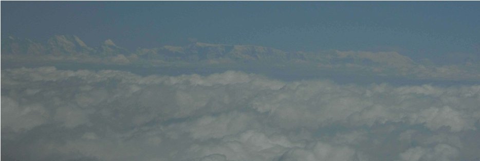
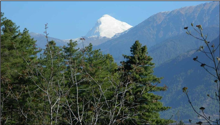
2 h 15 min flight to Dhaka. My first time landing in an airport in Bangladesh. The country appears as flat as a pancake. Druk Air serves a decent breakfast. Some passengers deplane, and are replaced by others, while Paro-bound passengers remain on the aircraft. We are on our way to Paro. Within 20 min, I can spot the high Himalaya on the horizon. The peak with multiple summits in the center field looks like Gankar Punzum (7,541 m), Bhutan’s highest mountain. There is a striking snow pyramid to the left though, and as we start turning right about 30 degrees, I realize that this has to be Jomolhari (7,314 m), Bhutan’s and Tibet’s sacred mountain. The views on the left, which I can glimpse from the other side of the aircraft are of Everest & Kanchenjunga!
We land after a 45 min flight. The weather is pleasant and partly cloudy. We disembark by stairway, and walk toward the arrival hall, which (along withe other terminal buildings) are very Bhutanese in construction. All the tourists are taking pictures from the tarmac of the aircraft, buildings etc., something that would never go down well in an Indian airport! I take one too. There is a large billboard by the building with a picture of the King and Queen of Bhutan, welcoming everyone to the country. Inside it’s a bit like being inside a monastery with much that is made of wood that is ornately carved with Buddhist iconography and images of dragons. All the Bhutanese officials are dressed in the national dress (gho for men, kira for women). There is a stern warning notice against importing porn into the country. When I get to the counter the official asks me where I am staying, and when I will be leaving, stamps my passport and waves me through. I pick up my bag and exit to be greeted by my travel agent, Karma Tshetem, who introduces me to my guide for the cultural tours, Kado Drukpa, and the driver for the Toyota SUV, Pasang. We head on to hotel Drukchen, which is quite close to the airport. The Hotel is built in Bhutanese style and my room has a wood floor and roof, and while spacious has a cozy feel. The bathroom is a modern one though.
While Karma takes my passport to fulfill formalities to get the trekking permit, I head on to visit Bhutan’s most famous monastery at Taktsang (“Tiger’s nest”) with Kado and Pasang. Kado tells me that usually he does not take people who have just landed in Paro (7,300′) to the monastery (~10,000′) because of potential altitude problems, but Karma had told him I could handle it! I tell him that I will know if I am not feeling well and turn back if that happens. I am reasonably confident I that should be able to do it, because I have hiked up Sierra peaks like Mt. Tallac on the same day after driving up from San Francisco.
We drive from the Hotel to the trailhead 5 miles up valley. There are many cars parked there. Kado tells me that tour groups generally are taken up early in the day to allow plenty of time for the hike with rests and time at the monastery. We are starting at noon, and I landed at 10 am!
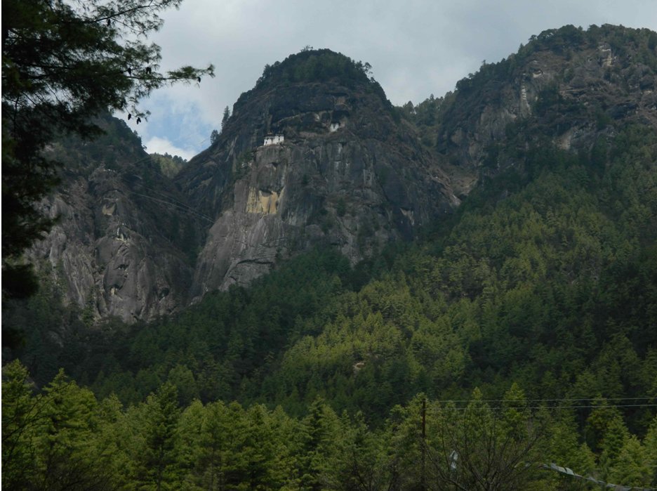
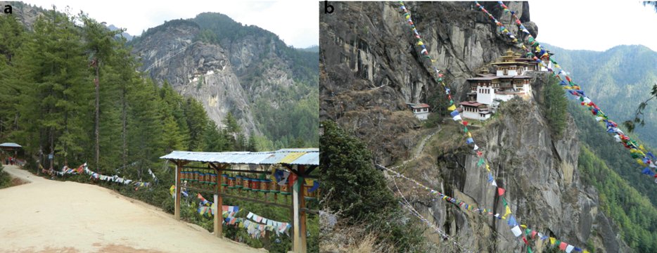
My altimeter reads 8,200′ at the trailhead. There are many vendors selling trinkets for the tourists. I look up at the monastery looming 2,000′ straight up a cliff. It looks amazing, and like it is growing out of the sheer cliff! We start up the trail through a pretty forest of blue pine, which switchbacks up the mountain to the left (north) of the cliff. We pass a large prayer wheel that is driven by water from a mountain stream so it is constantly turning. We meet several people on the way down – a German couple from Munich, Americans from Colorado, Indians from Pune and Delhi. Kado tells me that a lot of westerners are older. This is because they are charged US $250/day and retired people can afford this more than the young or middle-aged.
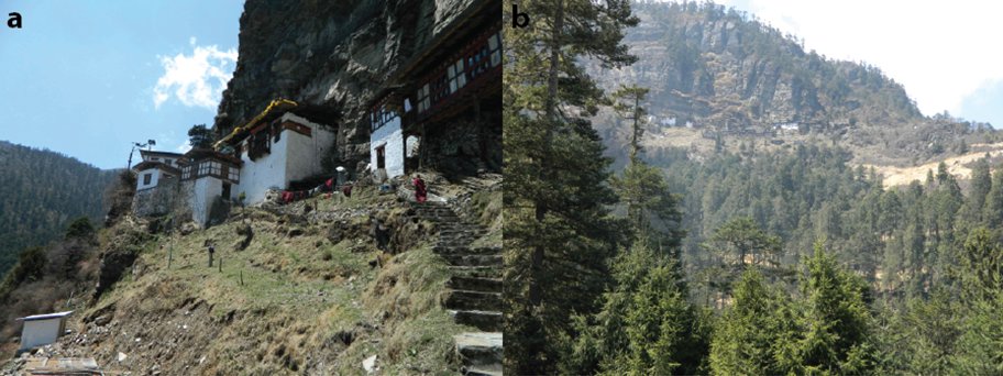
We reach a cafe that is a common rest stop, but decide to stop there on the way down. The trail steepens from there. There are plenty of trash cans alongside the entire trail, and I don’t see any rubbish. At a certain point Kado tells me it would be best to relieve myself as there are no decent restrooms ahead. As I climb downhill off the trail, I notice a rubbish pile on the slope. Hopefully someone will clean it up. We continue and climb to a view point where the monastery is directly across at eye level. This is where people who decide to ride a pony for the trip get dropped off. From there, in a final twist, the trail descends down to a bridge across a waterfall via a series of steps, and then climbs up to the monastery. Apparently this used to be a dangerous section on the route with a narrow trail and sheer drops until 1998. Tourists have even fallen to their deaths! Then the monastery was seriously damaged by fire and rebuilt by the government (they used pulleys to ferry building materials from the valley below up the cliff). During the rebuilding the trail was also improved and railings installed. We get to the monastery 2.5 hours after we have started. I have been feeling good so far. My altimeter reads 9,800′.
I have to deposit my camera as photography is not allowed in the monastery. I also put on my fleece, partly because it is windy and partly because I want to cover my half sleeve T-shirt. There is a strict dress code, especially for Bhutanese, who are not allowed in if they are not wearing their national dress!
We visit the 2 of the main shrines – the Guru Rimpoche drubkhang, which has a wood carved panel showing Guru Padmasambhava (Guru Rimpoche), the Indian monk who introduced Buddhism to Tibet, Ladakh and Bhutan in a fearsome form as the dorje drolo, seated on his wife who has been transformed into a tigress. He is supposed to have flown to Tiger’s Nest in this way and meditated in a cave, now sealed off, and behind the panel. The walls are covered in thangkhas, which in turn have plastic sheeting to protect then from the fumes of the butter and oil lamps. Though I am not religious, as is traditional in Buddhist and Hindu temples, I bow, pray for the well being of my family and a safe trip, and make a monetary offering. In the Sungjonma Lhakhang, Guru Rimpoche is depicted with his two consorts, one Indian, the other Tibetan. Oddly, I notice that a prominent offering is a 100 yuan/remimbi bill, which ironically has that doyen of godlessness, Chairman Mao on it!
As we are about to head back, I realize my stomach is rumbling, and I really need to use a restroom and can’t wait until we get back to the cafe, which is some distance away. After a scramble, Kado gets some toilet tissue from a monk, and I use a basic pit toilet, but feel much better after doing so.
I realize that I am now feeling a bit nauseous, probably from the altitude. I have an energy bar and then we continue down to the bridge, then climb up to the viewpoint. I meet a Gujarati couple from London, who were originally from Uganda. It’s the last day of a weeklong trip for them. We descend from the viewpoint to the cafe, where we have some tea and biscuits. By this time, all the tourists have left and we have the place to ourselves, while sitting outside and enjoying a great view of the monastery clinging to the cliff. The resident animals, three dogs and a cat gather by me as I am having tea, and the cat snuggles on my lap, before deciding to chase a squirrel that is feeding on food placed for it on an elevated platform. My nausea disappears after the tea break and we descend down to the trailhead. We meet a senior monk who is heading up with his dog. We get to the trailhead at 6 pm. Ours is the only car, and all the trinket sellers have vanished. It is close to sunset and the numerous stray dogs are now starting to be activated for the nightlong vigil.
We head back to the hotel, where I shower, before joining Kado for dinner. I have some soup, rice, mushrooms, asparagus and noodles. Kado allows me to share some of his ema datshi, Bhutan’s national dish, which has green chilies (as a vegetable!) in cheese sauce. As expected, this has a pungent taste, and I know Elizabeth could never eat this, but it is surprisingly pleasant, especially if you use adequate amounts of the sauce, and mix it with rice! At the end it’s nearly 9 pm, and time to turn in after a long, but exhilarating day!
April 9th, Visit to Cheli La and a hike to Kila nunnery.
Awake at 0300, thanks to Jet lag:( It’s first light at about 5 a. m., and I can see the odd plane land/ takeoff at Paro airport from my room window. Breakfast at the hotel at 7:30 a. m., and then we drive to the pass Cheli la, which links the Paro and Haa valleys. Above 11,000′, Mt. Jomolhari is clearly visible, but when we get to the pass, the clouds have veiled the mountain. They part briefly for a tantalizing glimpse before the curtain falls again. It’s only 10 a. m. Seems like in Bhutan, as in Sikkim, you have to get your mountains early.
The Border Roads Organization from India builds and maintains many of Bhutan’s roads. I don’t know who calibrates their altimeters, but they are way off. Their sign claims that the elevation is ‘3,988 m’ (13,100′) but my GPS tells me the elevation is 12,400′ (3,780 m). Even accounting for air pressure fluctuations, that’s a big difference. I’m more inclined to believe my altimeter because it showed the correct altitude at Paro and other places with published altitudes, and BRO is known to exaggerate (google “Khardung la”, the pass in Ladakh, for an example).
From the pass, Kado and I hike another 400′ up the ridge, then come down and cut across the conifer forest on the hillside to the Kila nunnery at 12,000′. The 3+ mile hike takes about 1.5-2 hours after negotiating some icy patches. The nunnery is spectacularly perched on the cliffside. We don’t visit the shrines, but head down to the main road where our car is waiting. We have to follow a dirt road for most of the way. The road certainly benefits the nuns because it allows provisions to be brought there easily. However construction of this rather basic road has disrupted the hiking trail, so it takes longer than it should. We are followed by the resident pair of shaggy mastiffs, all the way down to the car at 11,340′. Overall we have hiked about 5 miles above 11,000′ and I have not felt any problems with altitude.
Kado tells me that while monks are nominated by their families, nuns volunteer. I remember that in most Buddhist parts of the Himalaya like Ladakh, Himachal Pradesh and Sikkim, one male member of a large family often is given over to a Buddhist monastery. I suppose this might save the land owned by the family from being further divided, and the family gains merit by having a member in an ecclesiastical role. From the main road the nunnery is visible high above on the mountainside. As we are walking toward our car, we come across a 100 ngultrum bill by the roadside. Kado explains that Bhutanese often may not have time to go all the way up to the monastery, so when they sight it they close their eyes, make a wish, touch a bill to their foreheads and toss it out of the car as an offering. Concerned that it could fly away, he delicately tucks it into a tree trunk. I’m guessing that to take it might be considered sacrilege! Lance, if you are discreet, I think there might be rich pickings for someone with a metal detector:)
I ask Kado how a Bhutanese commoner is expected to interact with the King. He tells me that a commoner is forbidden to look directly at the King, only at his feet. He is to speak only when spoken to, and must be very respectful. Apparently education in Bhutan up to University is free. If a student wants to study further, he/she can apply for a very competitive government fellowship to study overseas, but then must also agree to return to Bhutan once their studies are complete. The wealthy do send their children overseas even for undergrad education. Kado also informs me that I am incorrect to refer to all Buddhist monks as ‘lamas’. Novices wearing maroon tunics are “gyelongs”. Lamas are senior religious scholars and priests who are distinguished from novices by the yellow jacket that they wear.
We return to the hotel and I call my parents using skype, which I realize is considerably cheaper than using roaming on my cell phone. We head to the main market in Paro. I buy two prayer flag rolls that I can use to gain “spiritual” merit by tying atop the Yeli La pass, which will be the highest point of my trek. I get one roll in yellow (representing the “earth” element, for people born in 1978) for Elizabeth, and I get a green roll (representing the “tree” element, for people born in 1975 and 2014) for myself and our expected child! I also get a solar powered prayer wheel that you can attach to the car dash after seeing it in the car that has been taking me around and thinking it’s cool. Back in the hotel, dinner and I’m off to bed at 2000, being too tired to sort my gear for the first trekking day tomorrow.
April 10th, Day 1 of trek: Zangapang–Shing Karap: 10 miles
I’m up at 0430 and have my gear sorted. Breakfast & we’re off at 0745 am to drive to the trailhead. As we get close to the ruined Drukgyel Dzong (Druk = dragon, gyel = victory), we see the summit pyramid of Jomolhari looming above the Paro Chhu valley. Cue photographs. Normally, the Jomolhari trek started at the Dzong, but now a dirt road has been extended all the way to the army camp at Gunitsawa village. We continue on this road to the hamlet of Zangapang, where we find the cook/guide Dorji & his assistant Rinchen waiting for us. Dorji looks stocky, while Rinchen looks decidedly plump and chubby-cheeked. He says he is doing a trek for the first time! They are cousins, both the children of Tibetan refugees. They grew up in India, but moved to Bhutan. The Bhutanese government has given them id cards. They have houses, but need to cough up enough money to the government here to prevent the houses from being repossessed, so making ends meet is not easy. Rinchen is here to learn the trade as an apprentice to Dorji. We communicate in pidgin Hindi.
We decide to start here (about 3.5 miles from Gunitsawa) and to continue past the normal first stage (Shana) for a couple of hours to Shing Karap. This will reduce the distance to be covered on the second day, which is usually a very long one. Kado and Pasang take their leave, and I give them tips in envelopes. The horseman has not yet arrived, so we wait. Finally he shows up. His name is Tsering and he is Bhutanese. He is very lean, taciturn and looks very fit, as I suppose one needs to be to chase after horses in mountainous terrain.
The gear is transferred to huge saddlebags and loaded onto the 7 horses. I feel like a ‘sahib’ during the British Raj traveling with an entourage! Dorji and I start at 10 a. m. while the horses are still being prepared and continue on the dirt road to the army camp, which we get to at 11:35 a. m. My trekking permit is inspected and endorsed. We wait for about an hour for the horses to catch up, while I snack on an energy bar. I offer a piece to a local stray dog, which sniffs it suspiciously before consuming it. He doesn’t express any interest in more. Maybe it’s the vanilla almond flavor?
Once the horses arrive, we continue. We pass a campsite on the opposite shore, which would have been our overnight stop had we started from Drukgyel Dzong. We approach a bridge to cross the Paro Chhu. It consists only of wooden planks with no railings above the raging torrent. There is a store by the bridge and Tsering pops in and lets Rinchen mind the horses as they cross over the bridge, which is a mistake. The horses cross, then bolt down a trail on the other side in the opposite direction (down valley), with Rinchen frantically chasing after them. I guess their instinct is to return home, and they will act on this if given a chance, and they can sense when they have an amateur in charge. While the horses are being retrieved, we stop for some lunch, which is roast chicken and some sandwiches.
The horses return and go on ahead, and we follow on the trail, which gradually ascends through the forest up valley. It’s quite rocky, but mostly dry. There are 2-3 clearings that can & have been used for camping. I see a lot of plastic and glass bottles on the trail. Dorji tells me these have probably been dropped by smugglers bringing goods from China, and that trekking crews have to clean and take out all their trash. The border between Bhutan and Tibet/China is not officially open for trade, but there’s plenty of illicit commercial traffic. I hope that’s true. I do see trash cans in some clearings and am told that forest service employees come to clean up. We come across two western trekkers who I am told are walking back from Jangothang to Gunitsawa in one day. That’s about 26 miles, even if it’s going downhill. I suspect they are doing this to save money as they have to pay $250 US a day.
We reach our camp at 3:30 pm. We have hiked about 9 miles, and the camp is at 10,150′ (3100 m). I discover that my contact lens solution bottle has been squished and it is completely empty! This is the first time I thought I might wear contacts the whole trip, but I guess that’s not going to happen. Hope nothing happens to my glasses since I have but one pair! In retrospect, I think it was best to get several pairs of contact lenses that are to be worn for a single day.
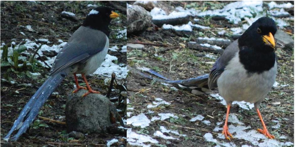
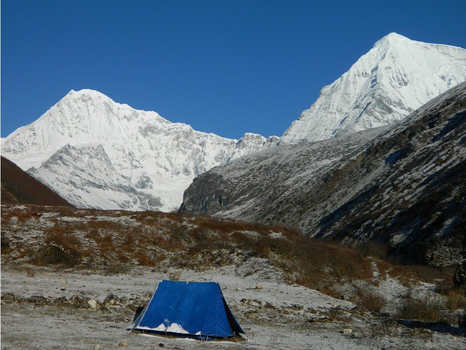
Tent buffeted, drizzle at 5 pm. Continues to rain, then sleet. Birds with brown plumage, black faces, red/orange beaks and striking long tails with white streaks – magpies. Toilet tent just for me. Hope it does not fly off while I’m pooping. Not easy communicating in pidgin Hindi, dining table does not work, one of the legs is deformed. Still to eat seated in a chair feels luxurious. Dinner menu fish, veggie curry, red rice, spinach with some chili in cheese sauce, vegetable soup, watermelon. Swallow a Diamox before bed at 8:30 pm.
April 11th, Day 2: Shing Karap (10,150′) – Thangthangka (11,890′): 8.1 miles.
I slept intermittently, but well. Had a series of vivid dreams (or ‘dreamlets’). In one, I explore deep sea pits with Jacques Cousteau and his son, and in another, I am participating in a sing-along of Handel’s Messiah.
It’s light by about 5:15 am. Read till 6 am, then step out to see that there’s snow on the ground & in the trees. The toilet tent has collapsed, so I don’t get to use it. The staff are dozing, but are up soon. I get ready and pack up the sleeping bag & mat. They have both been extremely comfortable. I have some tea while the horseman gets out feed for his horses & mules, which get agitated like hungry dogs about to get their dinner. The sun is up on the mountaintops by around 6:10 a.m., but the weather is somewhat cloudy/misty. I get a glimpse of the long-tailed birds (yellow-billed blue magpies).
Breakfast of porridge, toast with butter and jam and tea at 7:30 a.m. Packing is still going on at 8:40 a.m., so I decide to start and let the staff catch up. Walking on the snow-covered ground, I pass the shop at Shing Karap. Dorji catches up and we continue to a trail junction. The ascending trail to the left goes on to the Tremo La pass and to Tibet, while the descending trail is the one we take. We cross the river and continue on its ‘true left’. The trail is through mixed conifer forest. The snow shower from last night has laden the trees, and now that the sun is out bringing with it warmer temperatures, we are pelted with falling ice and snow for the rest of the day. A few icicles score direct hits on my neck. It’s a bit like being in a snowball fight! The trail is rocky and full of puddles from the snow melt. We make steady progress. On the way we meet two trekkers and accompanying staff who are coming from Jangothang, and two more who are coming via Soi Yaksa (a campsite on the second, shorter Jomolhari loop trek). Their guide says there is likely to be heavy snow on the way to the Thimphu Chhu valley (our planned route). We cross the river once more and stop for a tea break at 11:45 a.m. After tea, we continue across a second bridge. After some time traversing the slope on the opposite side through a series of ascents and descents, we cross a third bridge. Some distance from this bridge, the valley opens up, and the slopes of Mt. Jomolhari come into view, though the summit is not visible. There is a trail junction – the trail to the right crosses the river toward Soi Yaksa. We continue up the valley, and within 0.7 miles, reach our next campsite at Soi Thangthangka at 3,625 m (11,890’) after 8.1 miles and 5 hours. I see a group of elderly Japanese resting. I greet two of the women in Japanese, surprising them. They tell me that there has been quite a lot of snow in Jangothang, and they are heading down the valley.
The campsite has a shelter and kitchen space. New restrooms are being built. The toilet tent is erected for me, and I get to use it before it collapses! The staff have even brought a hollow stool to sit on, so I do not have to squat, Asian style. The caretaker for the campsite lives in a cabin close by. I nap for about an hour, then sit in his cabin by a fire. He tells me that there was nearly a foot of snow in the morning, but now it’s all gone. This is a worry for my trek. If there is too much snow, then the horseman will not risk his animals across the high passes, and we will have to turn back. I hear that there is good cell phone signal from Jangothang, so a conversation with the travel agent Karma might be helpful. We also have two nights in Jangothang to wait out any bad weather. The caretaker is sounding me out on getting him a job in the U.S. so he can emigrate! I do my best to explain the complexities of getting work visas, and that I do not run a business.
April 12th, Day 3: Soi Thangthangka (11,890′)–Jangothang (13,500’)
Up at 5:45 a.m. after turning in the previous night at 10 p.m. The local dogs woke me up intermittently through the night with their barking. Eventually had to use my ear plugs. Out of tent and Jomolhari is not visible. Perform my ablutions and pack up. By then the Sun is out, and the mountain is clearly visible, towering at the head of the valley! I hope the weather is also good at Jangothang for me to soak in the famous view from there. Perhaps I was too elated by the view, because I then sat on one of my bottles of hand sanitizer, crushing it and liberally dousing my clothes with alcohol.
Breakfast of pancakes with butter, jam and honey, and corn flakes. We start at 8:50 a.m. and continue to follow the river. After a brief ascent we meet a camp of the Indian Army. On hearing that I am a countryman, they invite me to have tea. I politely decline because we have a long way to go, but feel bad doing so. It can’t be a lot of fun for the average Indian army soldier or officer to spend a long time in this relatively remote location, and though the views are splendid, I can imagine they would grate on you after a while. It’s certainly different being a tourist vs. a professional soldier away from family!
The camp of the Royal Bhutan army is located close by. My permit for the trek is once again inspected. This is the last location where my permit will be checked. On continuing, we come across the first yaks grazing on steep slopes on the opposite (left) side of the river. We are nearly above the tree line. Jomolhari is still visible, but soon disappears behind a ridge. We pass small villages as we continue up the valley, slowly gaining altitude. After about 3 hours, we stop for a tea break. We are at 12,940’. On continuing, we pass the village of Soe, which has a school, several houses, and a clinic (open 9 a.m. to 3 p.m. Monday to Friday, and 9 a.m. to 1 p.m. on Saturday). There are many dogs that bark at us to alleviate their boredom. We reach our next campsite, Jangothang, a wide meadow, at 1:45 p.m. The slopes of Jomolhari are visible up a side valley. There are some ruined Dzong-like fortifications, and a large shelter for sleeping and cooking. Nevertheless, my tent is pitched with the entrance facing in the direction of Jomolhari, so that I just have to look out in the morning, when the mountain will hopefully be visible! There are 3 other groups and they plan to leave the next day to cross the first high pass, Nyile La, to Lingshi.
It starts to snow. I doze in my tent after reading some of my cousin, Aroon Raman’s latest novel, The Treasure of Kafur. It is most entertaining. When I wake at 6:30 p.m., there is a dusting of snow on the ground. I have a conversation with the group of Germans who want to know what they can do if they get sick from the altitude – they are feeling fine so far. After dinner, I hope for good weather when we will cross the passes, or else we will have to head back down the valley the way we came!
April 13th, Day 4: Jangothang rest day, excursion to the Tsophu lakes at 14,450’.
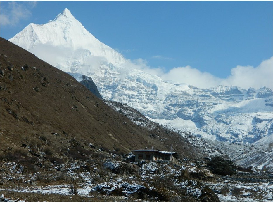
Up at 5:15 a. m. Look out of the tent, but the ‘mountain’ is invisible. There are a few inches of snow on the ground. The weather to the south and north looks to be clearing though, and the clouds around Jomolhari to the west are also slowly lifting. By 6:30 a. m., the mountain is completely visible, as is the subsidiary peak, Jomolhari II (22,800’) to the north of the main peak. I’m very happy to see the wonderful view. Now I may not mind as much if the weather makes it difficult to continue across the high passes.
View of Jomolhari (7,314 m, 23,997’) and Jomolhari II (to the right) from Jangothang. In the background is the shelter, with the pack animals outside.
After a breakfast of bacon, toast and porridge, Dorji and I head to the Tsophu lakes for an acclimatization walk. It’s 9:10 a. m., and by now the clouds are starting to accumulate around Jomolhari. It seems like I am at a temple in India for worship, where the inner sanctum is opened only at specific times of the day for devotees to get a glimpse of the deity.
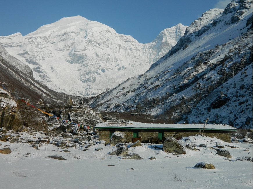
We head up the main valley. The peak of Jichu Drakye (6,794 m – 22,270’) appears at the head of the main valley. It is a spectacular peak with an elegantly-shaped summit pyramid. We cross the river, now just a fast-flowing stream, and ascend steeply on the opposite bank on the snow-covered trail until we reach the top of the slope at ~ 14,100’. In front of us is a gently sloping side valley and behind us is a bird’s eye view of Jangothang and the Paro Chhu valley.
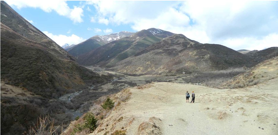
Panorama of upper Paro Chhu valley from above Jangothang at ~14,000’. The campsite at Jangothang is to the left, while the slopes of Jichu Drakye are to the right.
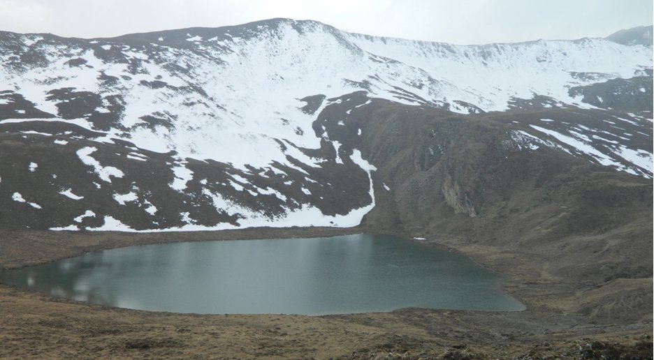
We continue up valley alongside a dry river bed, gradually gaining altitude. We see marmots that dive into their holes as we approach, and many grazing yaks. At about 11:30 a. m., we reach the first Tsophu lake at 14,450’. There is one more lake further up the valley, but this is as far as we will go. The trail skirts the lake and continues SE towards the Bhonte La pass – an alternative circuit that leads back to our trek’s starting point. The lake supposedly has trout, but there is a sign saying that fishing is strictly prohibited. I have some tea and cookies, meanwhile Dorji walks to the opposite side of the lake to tie prayer flags.
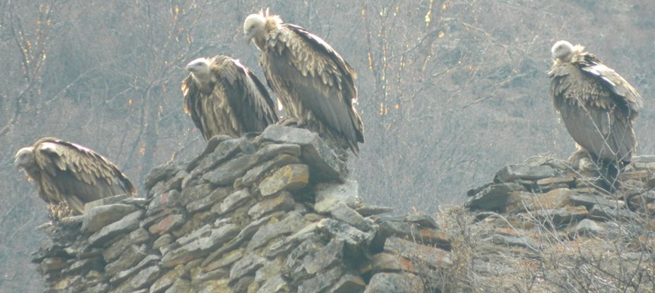
The snow on the trail has melted by the time we head back. The mountains are covered in cloud though. On the way, we meet a man leading his horses toward Lingshi. This bodes well for our pass crossing the next day. Back in camp at 1:30 p.m. A new group of 5 Germans arrives. I get to chatting with them, and they tell me a common high school friend who lives in Thimphu organized the trek as a reunion for them. I am thrilled to see several Himalayan vultures lounging on the ruins of the old dzong above Jangothang. They are huge, impressive birds! There are also the ubiquitous Himalayan choughs. I spend the rest of the time reading and praying for good weather for the next day.
April 14th, Day 5: Jangothang–Lingshi (13,200’) across Nyile La (16,030’)
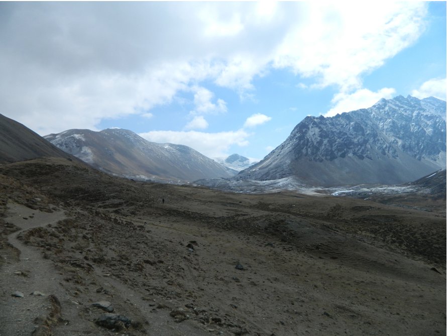
Up at 5 a.m. The campsite is free of snow, but the mountains are obscured by clouds. There are low clouds toward the E–NE, our direction for the day, and fresh snow seems to have fallen in the side valley where we hiked the previous day. However, I am optimistic that the snow will melt when the Sun is out. We start at 7:50 a. m. after my breakfast of pancakes with butter, jam and honey. We head slowly up the valley past the remaining houses, mainly occupied by yak herders. On the way, I meet four kids heading down valley to the school at Soe. They are dressed in uniform and on seeing me, chorus “Good morning, Sir!” It is endearing and reminds me of my childhood growing up in India. I reciprocate their greeting. We continue past the last house and onto a bridge across the stream. Once the other side, we climb steeply for about an hour until the trail levels off at the start of a different side valley at ~ 14,150’. It is quite cold. The mountains across the valley are still veiled in cloud. We continue up the side valley, gradually gaining altitude. The landscape is mostly arid, and it feels like I am back in Ladakh, where I did several treks in the 1990s. It looks flat, and an easy hike, but the gradually increasing altitude makes it hard.
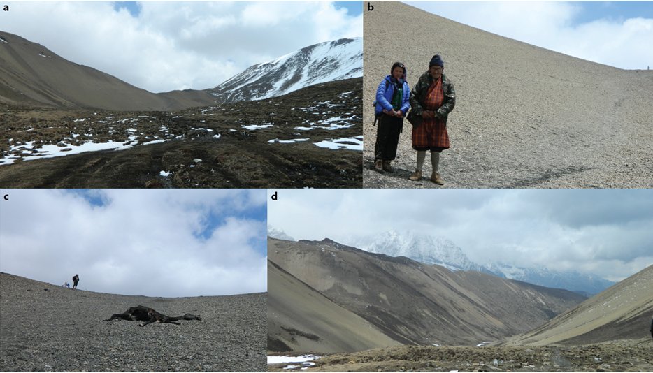
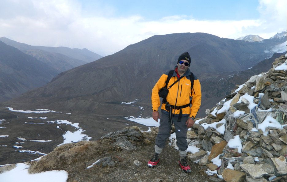
To the south in the broad expanse are streams from glacial melt. After 2.5 hours, we started to ascend a ridge to the north toward another side valley. I reach a chorten after 3 hours from our start at 15,420’. This is only a false summit though. The pass lies up at the head of the side valley. By this time Rinchen has fallen behind Dorji and me. Dorji decides to wait for him to catch up while I continue, descending briefly to a stream, crossing it and continuing up a scree slope. At a bend in the slope, I can see the prayer flags at the pass. I can see a vulture circling. I cross another stream and a tussocky patch to the final scree slope leading to the top of the pass. I meet an old man and his granddaughter, who are finishing a snack before the final stretch. Dorji catches up and informs me that Rinchen is not doing well – he has clearly been affected by the altitude and his lack of experience and fitness. Dorji gave him some tea and biscuits while he rested. We continue up the final slope, and just before the top, come upon a carcass of a yak. It has been mostly consumed. I guess this was what the vulture was after. At the top at 16,030’, it is very windy. I take some pictures and videos, even though I can only see the lower slopes of Jomolhari, Jichu Drakye and Tserim Gang. Rinchen is still not visible.
a. The final stretch toward Nyile La., b. Old man and his granddaughter below the final slopes leading to the top., c. Approaching the top of Nyile La. The carcass of a dead yak that most likely perished from starvation., d. View from the Nyile La looking North. The slopes of Tserim Gang (22,300’) are visible.
We descend a steep scree slope and cross several snowy patches, though there was no snow on top of the pass. I get to test out my kahtoola spikes at one of the icy patches. When we are 400’ down we finally see another figure appear at the summit of the pass – we hope that it is Rinchen. He should feel much better descending! We descend to 15,200’ and break for some tea, waiting until Rinchen finally joins us. He says he though he was going to die(!) and used his knowledge from his training as a monk to pray fervently for himself. We continue down a narrow valley to a point where we cross the stream to the slopes on the other side at 14,700’. Here we stop for lunch, and Rinchen tucks in. Part of his problem was also that he did not have anything to eat in the morning, and had a cough, which made his condition worse. I tell him only his Tibetan ancestry and his possibly greater genetic resistance to the effects of altitude could have got him through this! If I, a landlubber by comparison, was doing my first trek with such little preparation, I don’t think I would have stood a chance!
On the other side of the stream, the trail winds, mostly level, along the slope high above the stream, and is at times quite narrow. I would not want to run into a herd of yaks coming in the opposite direction! I see quite a few yaks lounging on the steep hillside, and by the stream far below. After another 2.5 miles, we can see the Lingshi Dzong in the distance, as well as an army camp on the valley floor. The trail continues to a lookout at 14,400’ where we can see the dzong across a deep valley, and the slopes of Jichu Drakye and Tserim Gang (22,300’), as well as a large stone shelter close to the glacier emanating from the peaks that is probably used by yak herders. At this stage the trail descends steeply down to the campsite and Dorji hurries away. Rinchen stays with me and tells me that Dorji is going to make some tea for us, and told Rinchen to bring me down. I am not pleased at this, and after a lot of shouting and whistling we get Dorji to stop, and catch up with him. Rinchen has never been on this trail before, and I inform Dorji that it is his job to serve as guide until we reach the camp; tea can wait!
Descending down, we can see that Tsering has already erected the tents. We reach the campsite at the floor of the valley at 13,130’, and I have a slight headache. I have an advil and a nap and wake to find that it is snowing lightly. Dinner of beef, ema datshi, pasta and white rice. To bed at 10 p.m.
April 15th, Day 6: Rest day at Lingshi, visit to Lingshi (Yugyel) Dzong.
I’m up at 5 a.m., but doze until 6:30 a.m., then come out of the tent. It is crystal clear and I am greeted by a terrific view of Jichu Drakye and Tserim Gang. Light snow on the ground, but it melts once the sun comes up. Breakfast of French toast, sausage and porridge. Rinchen seems to be feeling better.
We leave to visit the Lingshi Dzong at 9:30 a. m. We go down valley and cross the stream at a wooden bridge, then climb up the hillside until we reach a chorten at 13,600’. The view is great in all directions with clear weather. We climb another 300’ to the Dzong. From there, we can see the valley we will be traveling through on the way to the Yeli La toward Thimphu. The main chamber (lhakhang) of the dzong is closed, and there is no one about. Rinchen and Dorji tie prayer flags and head down to the village to see if they can recharge their cell phones. I head back to the camp and am back at 12:10 p. m.
As I get back to camp, Tsering is sunning himself. Soon after I return, clouds come from nowhere and then comes the precipitation! It’s snow pellets – I later learn the correct term for this is ‘graupel’. After intermittent spells, the precipitation stops by 5 p. m. Meanwhile, Dorji and Rinchen have returned. Apparently there were few people at the village as well. All the villagers had gone to a nearby shrine for worship. The staff collect dried wood to build a campfire. I ask them if this is legal, and they seem to think it is so. My Lonely planet guide does not agree, but then the author points out that cultural events are often organized for western tourists at remote villages, and often involve bonfires, and enforcement of a law banning campfires is difficult.
A Canadian trekker and his guide, followed by his staff arrive while the graupel is coming down. Apparently he had two other people in his group, but they both bailed because of altitude sickness. What a shame, especially if one has paid at the very least, $250 per day. He is doing a longer trek to Laya (a 12–13 day trek).
I enjoy the warmth of the campfire that the staff have built. It is now clear, and there is the beautiful sight of the mountains in the moonlight. So far, I have not had any trekkers traveling in the same direction as myself on the same day, and I’ve enjoyed not being on a crowded trail!
April 16th, Day 7: Lingshi-Shodu via Yeli La (16,240’)
There is no repeat of the previous day’s crystal clear conditions this morning. I can see the slopes of Jichu Drakye and Tserim Gang, but the not the upper mountain. We start at 8 a. m. The trail climbs the hillside east of the campsite to a chorten, and then swings south up the Mo Chhu (‘mother river’) valley. We descend to the picturesque valley floor. There are some villagers from the Lingshi collecting wood. Their dog is keeping them company. He is a huge, black and handsome, almost like a purebred Newfoundland. I’ve noticed that most dogs in Bhutan are strays that are adopted and look well cared for, unlike strays in India, which are often ill-treated, and struggle to survive on the streets of large cities.
We continue up the river valley for about 3.5 hours, when we reach a bridge across the stream at 14,700’. The Lingshi Dzong is visible in the distance.
A short distance from the stream, at 14,800’, and 7 miles from Lingshi, we start ascending the slope to a side valley that leads to the Yeli La. We pass many huge yaks that eye us warily. I give them a wide berth, as they can be temperamental, and I’m not sure I have the energy to outrun a charging beast given the altitude! We continue up the side valley. It is overcast. Before the final steep ascent to the pass, we stop for a tea break at 15,800’. I attach my kahtoola spikes to my boots, because the rest of the way is a mix of snow, rocks and perhaps some ice. The final stretch is quite narrow. We get to the top of the pass, 7 hours after starting from camp. My altimeter indicates that we are at 16,240’, the highest point of the trek. We spend about 30 minutes on top. It is overcast, and cold, and soon starts snowing. I tie two sets of prayer flags on the rocks at the summit – 1 yellow for Elizabeth, and 1 green to seek divine favor for myself and our unborn child. Rinchen, capitalizing on his training as a lama, performs ‘puja’ (worship).
The descent on the south side is gradual. At 15,700’ we pass the lake of Khedo Tso, which is the source for the Wang Chhu river that flows through Thimphu.
The snow abates, and we stopped for a quick lunch, but it is cold and uncomfortable. We descend down the plateau and emerge above a valley, crossing many small streams that coalesce. We descend to the valley floor and it starts to snow. We continue for about 1 hour, crossing the stream once, until we reach our next campsite of Shodu (13,300’) at 6:30 p. m. Tsering, as usual has preceded us and erected the tents. But the saddle bags have been left out in the snow, and I let him know that they need to be brought into a shelter the next day, especially since it is more likely to rain now that we are descending. I am also irritated that my tent has been pitched some distance from the kitchen tent, but I suspect the long day has taken its toll! It’s heaven to put on a new set of clothes, before dinner and bed at 9:30 p. m.
April 17th: Day 8 – Shodu–Barshong–Ta Gume Thang ~16 miles.
Dorji and I make an 8 a. m. start after breakfast to another long day. Rinchen and Tsering will follow after they pack up the camp. We immediately cross the river by a wooden bridge to the left (North) side. This is the first of seven crossings, all using wooden bridges. The valley is asymmetric. We are at the tree line, and the right (South) side has conifer forest, while the North side has steep rock cliffs. Dorji loses the trail as we contour the hillside above the river and then see the trail at the bottom of the valley. The result is that we have to make a slightly hairy steep descent down the mountainside to the trail. I am cranky and berate him to be more careful next time. I don’t enjoy coming steeply downhill, which hurts my knees. The trail ascends again and contours cliffs dropping down to the water, before descending via a steep stone staircase to the river.
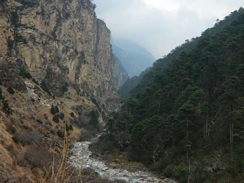
Descending the Wang Chhu valley with steep cliffs on the North side and conifer forest on the South Bank. The trail on the North side is visible below the cliffs.
We cross to the South side, and I find the trail on the opposite bank through the forest is harder going. It has rained the previous night, and there is thick mud on the trail. Where possible, we make detours to avoid sinking into the mire. Tsering and Rinchen pass us a few hours from camp with the aim of making straight for our next camp, which is still a long way down the valley.
As Dorji and I continue, I try to get a sense of Rinchen, who has been a misfit among the trekking staff. I want to understand his circumstances better, so I know how much “baksheesh” (tip) to give him at the end of the trek. This is important, because tips are an important source of income for trekking staff in the Himalaya. Trekking agencies that employ staff often make a profit by paying them as little as they can, while charging customers like me much more than I would pay if I organized the trek myself by engaging a cook and horseman independently. During the conversation, I learn that the cook gets paid Rs./Ngu. 800/day and his assistant Rs./Ngu. 400/day (Indian rupees are accepted as legal tender in Bhutan). The horseman is paid Rs./Ngu. 250/horse/day. This latter amount seems very low. I remember hiring horses in Ladakh 20 years earlier, and paying Rs. 150/horse/day. Tsering will be paid an extra days’ wages because he has to get his horses back to Paro from the trek’s endpoint at Dodina, near Thimphu. Apparently, there is no shortage of horses in the Paro valley, so the economics of supply and demand apply. For the Snowman trek (the longest trek in Bhutan, and supposedly one of the most difficult in the world because of the numerous high pass crossings), the rate is Rs./Ngu. 350/horse/day, presumably because of the longer duration of the trek in remote areas. The rate rises to Rs./Ngu. 500/horse/day while trekking in Eastern Bhutan, where horses are hard to come by. The staff also freelance. During the trekking season, they will work for any travel agency that needs them. It is only the largest travel agencies that can employ permanent staff.
Dorji tells me that Rinchen has been little help, because he a) has had no experience trekking, setting up tents etc., b) Has been sick with a cough, and maybe a little from the altitude and c) is physically unfit. I ask him why he hired him as an assistant if that was the case (the cook can choose who he wants as an assistant). It turns out that they are cousins. Rinchen’s mother died, and his father remarried, then moved to his new wife’s home and abandoned him. There was nobody to provide for him, so he decided to take holy orders by joining a monastery. He spent 15 years in the monastery, training to be a priest. However, this training was affected by his not being in good health. Rinchen apparently suffers from hypertension and was (and is) often unwell. He also got on poorly with the mom of one of the reincarnate lamas (a tulku) that he was working under, and so he quit the monastery. He decided to get a driver’s license and to drive cars for a living in the lowlands of Bhutan. At this point he had completed his driver’s training and got his license. He had been badgering Dorji to hire him as an assistant so he could make some extra money, and so Dorji decided to do him a good turn, and then regretted it, because Rinchen has not significantly reduced his workload.
I was appalled to hear that Dorji brought a guy with hypertension on a trek with pass crossings over 16,000’! Given that Rinchen thought he was going to die while crossing the first pass (Nyile La at 16,030’), this could actually have happened given his medical history, and would have been a tragedy. We would have been unable to do anything to help him. I gathered that Dorji did not realize that hypertension could cause problems at high altitudes. However, after hearing the whole sad story of Rinchen’s upbringing, I figure I will not be harsh when it comes to supplementing his income.
After 3 hours we stop for a break in a clearing for some tea and cookies. We have descended about 1,400’ from Shodu. We descend another 300’, and then the trail sadistically climbs steeply for ~800’, then descends 200’ and skirts the mountainside high above the river until we reach the village of Barshong. It is quite exhausting after the long day yesterday. Barshong has a ruined dzong that is in the process of being restored. We stop for some lunch as I find I have likely exhausted my reserves over the last week. We are also able to get cell phone signal on Dorji and Rinchen’s phones, so we can call Karma (the travel agent) to let him know that I would like to “telescope” the last three days of walking into two days, so I will be at the roadhead a day earlier. I ask him to arrange to pick me up, and talk about the possibility of visiting Punakha Dzong the next day from Thimphu. He asks when I will be at the end of the trail. We have an amusing exchange:
Me: “Karma, I think it will be at about 3 p.m. After all these long days, I’ve run out of gas (i.e. I am walking slower).”
Karma: “That is not a problem. Since you are out of the National Park boundary, you can use wood for cooking.”
After lunch we continue by crossing a landslide area. The trail has been damaged and the path is narrow across an unstable slope. The trail gradually descends all the way down to the river. During the descent we meet a few men who are carrying up large beams of wood strapped to their backs to repair houses in Barshong. It’s got to take a lot of strength walking uphill with something like that strapped to your back with thin cords! To make way for people and animals on the narrow trail, the guys turn to advance sideways past us, with the beams pointing forward! After about 1.5 hours we were down by the river, and it was a short walk to our camp by the river in a clearing called Ta Gume Thang (“waiting for horses”; Ta = horse, Thang = flat) at about 11,100’. A long exhausting day, at the end of which it started to rain. I get to read Elizabeth’s last letter (marked “read at Dolam Kencho”, but we were going to by-pass Dolam Kencho the next day, the last of the trek).
At dinner, I try to find out more about the taciturn Tsering. Tsering was a soldier in the Royal Bhutanese army for several years, then quit. He has a wife and three kids, and during the trekking season he serves as a horseman for groups in the Jomolhari region. Outside the trekking season, he admitted to smuggling goods from China. He takes his horses and mules and brings them back laden with goods from across the border. Trade between Bhutan and China is not legally sanctioned. Clearly, the Bhutanese and Indian army patrols are there to prevent it. Apparently the Chinese don’t care, since their goods are reaching the Bhutanese market. The only thing the Chinese care about are statuettes or artifacts that bear images of the Dalai Lama or the Tibetan government in exile – apparently this can cause serious problems with their ‘business’ transactions. Tsering avoids the patrols by going at night across passes such as the 16,400’ high Tremo La, which is immediately south of Jomolhari. Perhaps he also has an ‘understanding’ with some of the border patrols, so that they look the other way during his trips in return for favors or a cut in the profits.
Since this is the last dinner with the staff, Dorji prepares a special dish – a pizza with ground chicken and cheese. I suggest putting a fried-egg, sunny-side up, on top and it tastes quite good. We all share it.
April 18th: Day 9 – Ta Gume Thang – Dodina ~ 13.5 miles
The last day of the trek. Unusually, the staff are up before me (@ 5-ish). Perhaps they are eager to finish the job. They will have a brief respite of 1-2 days, and Dorji and Tsering will return to the beginning of the route with another group! I’m told that Tsering will offload the bags at the roadhead and take off. Rinchen is to wait with the bags until Dorji and I show up. I slip Tsering his tip (Ngu. 2,000) in an envelope before I leave. He has generally worked hard, but sometimes needs to be told obvious things, such as not to leave my bags out in the rain or snow when he gets to the campsite early (as he always does). Dorji and I start earlier and head down the river valley, descending for 3 hours. At one point while following the river to the left on the valley floor, Dorji stops and says we should climb the slope to by-pass the coming section above the river, as the trail is likely to have been obliterated by the river ahead. I am skeptical, both from mistakes from the previous day and the fact that the trail we are standing on looks perfectly good, and I can’t see a decent trail up on the slope above the river. I suggest we continue on the valley floor. I don’t mind a little water. If the trail has indeed been washed away, we will retrace our steps. My judgment is vindicated as we find that a new path has been carved into the walls of the canyon a few feet from the river, allowing us passage.
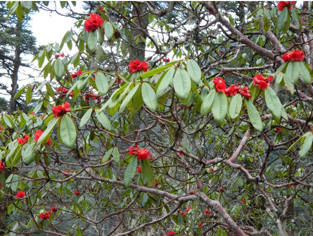
It is not as exhausting as the previous day though we still ascend and descend ridges by the river. There is then a steep ascent of about 1,000’ above the river. We walk through rhododendron forest and reach a turnoff for the Dolam Kencho campsite. I can see the campsite on a meadow a few hundred feet below. Dorji tells me trekking staff prefer to avoid this campsite because the water source is not close to the campsite.
From the trail junction, we climb to a crest called Merab Labtsha at ~ 11,600’. It’s taken 4 hours and we have walked about 7 miles. There is a cairn with an effigy of a person that has been clothed in an old leather jacket. We stop for a packed lunch for 30 minutes. After this there is a knee-jarring descent of 1,600’, then the trail climbs again to another crest (Jaknam Labtsha) at ~ 10,300’. It’s hot and sticky. Continuing downhill again, we reach the dirt road leading to Dodina at 3 p.m. at 9,700’ and after 10.8 miles of walking. I expect to find our luggage, Rinchen and a car waiting here, but the area is deserted. We hear from Karma on the phone that the vehicle is still on its way, so we surmise that Tsering, not finding any waiting vehicle, decided to continue to Dodina. That is smart in case the road is not passable to that point; we will not need to lug the bags downhill. We continue down the dirt road for another 1.8 mile and ~ 800’. We are nearly level with the river again when we meet the car with Karma and the driver Sonam. I am greeted with a khata (a silk scarf that is often presented as a token of respect to visitors, and often presented at a monastery as an offering) and a bottle of coke. I’m normally not a soda drinker, but a coke tastes great after a long day of hiking! We continue in the car for another mile and run into Rinchen who is waiting with the bags. I bid farewell to him and Dorji and give them their tips (Ngu. 1,100 to Rinchen and Ngu. 2,500 to Dorji) along with advice to Rinchen never to go trekking this high again with his health problems. Karma and I continue by car to Thimphu to Hotel Taktsang. It feels great to clean up, and I take a walk around the hotel in Central Thimphu. There are policemen directing traffic at the intersections with tourists taking pictures (Thimphu does not have traffic lights). I decide to continue eating Bhutanese food at the hotel while I can for dinner before turning in.
April 19th: Thimphu and Paro.
Up at 7 a.m. after a restful sleep. Breakfast at 8 a.m. in the hotel’s restaurant – coffee/tea, eggs with sausage and toast. Called Karma at ~ 9 a.m., only to find that a trip to Punakha is not on. Annoying, but he forgot that it’s a Saturday! He should have acquired a permit the previous day. After all, I did call him on a Thursday from Barshong. Later, he mentioned that they (the army or whoever issues the permits) would have needed to see my passport anyway, which he did not have.
I start thinking about what I would like to see in Thimphu and Paro during the day. When Karma and Sonam show up, we go first to see some of Thimphu’s attractions:
1. The hospital specializing in traditional medicine, and the associated museum, which has extensive samples of herbs, roots, etc., for treating various disease conditions. There are quite a few patients waiting to be treated.
2. The school of traditional art: We see many students working on traditional paintings (mostly boys/men), embroidery (women), wood-carving (there was a Westerner who looked hippie-ish, also carving away), and sculpture (using clay).
Apparently, students study for a long time (4-6 years) to ‘graduate’ in a particular discipline. But to do so, they must have dropped out of the ‘conventional’ school. It seems that the Bhutanese education system does not allow one to pursue both academic excellence in Science/Math and excellence in traditional art forms. I’m not sure I would want to risk my job prospects by not finishing a high school education and going to an ‘art’ school instead.
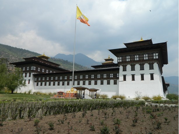
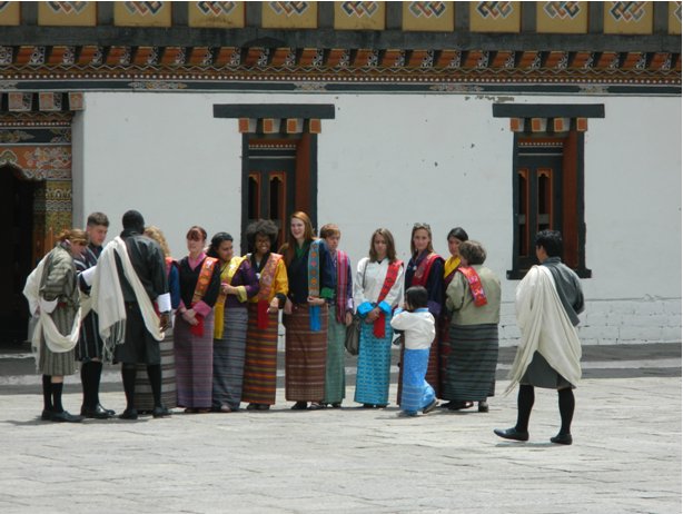
3. Trashi Choe Dzong: This is a major dzong in the Thimphu area, containing religious and administrative buildings. We parked and entered the grounds, which were very peaceful, with the odd soldiers on guard duty, probably because it was the weekend. Karma showed me the King’s residence, a relatively modest building adjacent to the dzong. We entered the main courtyard and saw the main prayer hall with thrones for the King, his father, and the Chief Abbott (the Je Khenpo). Returning outside, we saw a large group of Americans dressed in Bhutanese attire. They looked impressive! I wish I could wear a gho, but I will likely save that for my next trip!
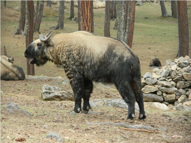
4. Motithang Takin reserve: I would generally prefer not to see animals in enclosures, but I decide to make an exception for the takin, Bhutan’s national animal, which I have not seen before. The reserve is packed with tourists (a lot of them Indian) gawking at the cuddly, oversized goat-like antelopes behind bars that seemed to enjoy the attention.
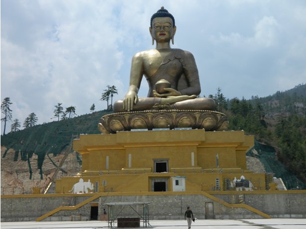
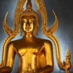
5. Buddha Statue: A huge golden statue of the Buddha (169’ tall) has been built on a hill above Thimphu. A temple under the statue is still under construction. The majority of funding for this comes from private donors from China and elsewhere. We are here because Karma tells me that the hill offers the best view of Thimphu, and it is indeed one that encompasses the whole valley, with the Government buildings on the North side and the southern approaches.
After this tour, we head to central Thimphu for lunch. Karma has made reservations at the Edelweiss restaurant. The streets close to the restaurant have been closed off. There is a presentation ceremony going on for a Paro–Thimphu bike race organized by India’s Border Roads Organization. Local dignitaries are making speeches and there’s loud electronic music playing in the background.
The restaurant is on the 4th floor with a view of the city center. There’s a lunch buffet divided into 2 sections – one for the western tourists and one for the Bhutanese. The tourists’ buffet has rice, noodles, meat, sweet and sour vegetables and generally mildly spiced food. There’s a small container with ema datshi – clearly the tourists are not expected to have much of this! The Bhutanese section has the more spicy traditional dishes.
After lunch, Karma bid me goodbye and I head down to Paro with the driver Sonam. We head south down the Wang Chhu valley and then up the Paro Chhu valley. It’s 32 miles and takes about 1 hour and 10 minutes. Our next stop is the National museum, for which we need to take a circuitous route to the top of the hill with the ta dzong, the watchtower for Paro’s dzong. The museum is small, with collection of masks used in traditional dances, a fine collection of old thangkhas and a more extensive section on Bhutan’s geology and geography. Outside, there is a fine view of the Paro valley.
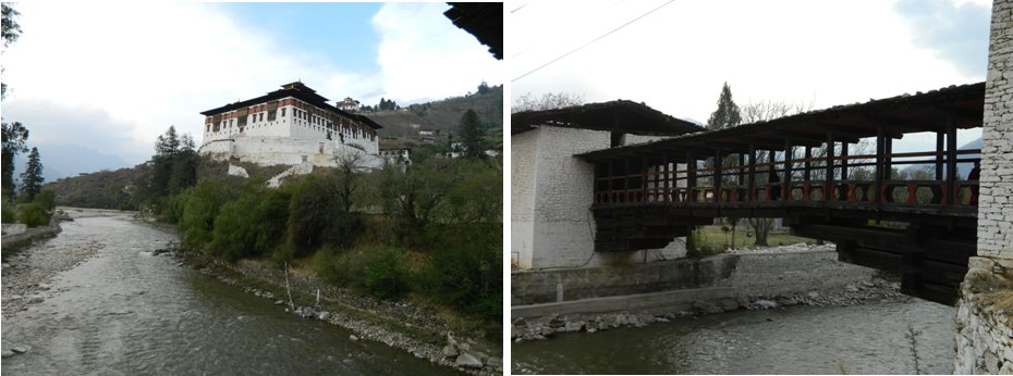
We go to the imposing dzong next. It is mostly deserted except for a few monks and tourists. Most of the chambers are not accessible, but we do get to see the monks’ prayer hall. We also get a good view of an aircraft as it circles the valley, before landing at the Paro airfield.
On the way to the Hotel Drukchen, we stop at the charming traditional covered wooden bridge across the Paro Chhu to the dzong. At the hotel, I am upgraded to a suite(!), which is very comfortable. My dinner is again a Bhutanese meal of Ema, Kewa and Shamu (mushrooms) datshi, while watching a bit of the James Bond “The World is Not Enough”.
April 20th: Departure
My last morning in Bhutan. My flight is at 10:50 am to Bangkok via Guwahati in India. After breakfast, I am off to the airport at there by 7:50 am in an effort to get a window seat. The x-ray machines have not started up yet, and since all bags have to be x-rayed to get to the check-in counter, I have to wait. I am second in line. Meanwhile, I exchange my remaining ngultrum into US dollars. The staff at the bank are reluctant to do this as I have an Indian passport. They finally agree after seeing that I am not traveling to India, and that I live in the US. There’s a souvenir shop in the airport, but there is nothing there that catches my eye.
The x-ray machines finally start operating at 8:30 a.m. By this time there is a long line of passengers. Once my bags have been x-rayed, I see that most of the passengers are lining up to check-in for the Bhutan airlines flight that departs earlier, and I am the first to check-in for the Druk Air flight. I have to wait some more time until the flight appears on the computer and the agent can check me in. I get a window seat on the right as I wanted.
There is a delay at immigration as the agent re-directs me to her supervisor’s office. I wait there 20 minutes while he checks various details on his computer and asks me questions about my trip. I surmise that there is some confusion because I have an Indian passport, live in the U.S. and am flying to Bangkok.
Finally through immigration, call Elizabeth using the free Wi-Fi, then we board. The views are not great after takeoff – it’s somewhat cloudy, and while the mountains are visible, they appear distant and it’s hard to clearly identify them. It probably does not help that we are heading South-East. The view is also likely better flying in to Paro because the flight is descending from cruising altitude while close to the high peaks, rather than climbing to cruising altitude and likely to get there while more distant from the mountains.
The flight to Guwahati is short (35 minutes). I do not see one of the great rivers of the Indian subcontinent, the Brahmaputra as we come in to land, but do see the river after we take off again 45 minutes later – it’s really wide as I expected.
I am sitting in an exit row. To my left is a kid named Khenrub. He is Bhutanese, but is studying at an international school in Chiang Mai in Thailand. His parents sent him overseas to study after 6th grade, because the education in Bhutan is not good enough. He will graduate in a few months and will go on to the U. S. to Dennison University in OH as an undergrad.
Sitting at the aisle seat is a man from South Bhutan who teaches Math and Science in a school in Thailand. We have a discussion on whether Bhutan is worth the steep 250 USD tariff that most foreign tourists pay. I think not, especially for trekking. I can see how, when compared to Nepal’s famous treks, Bhutan might offer a higher quality experience because one shares the trail with fewer trekkers. However, there are many treks in the Indian Himalaya that are equally spectacular and without many trekkers that can be enjoyed for a fraction of the cost incurred in Bhutan.
I land in Bangkok, and it only takes an hour to get off the plane, get a ‘visa on arrival’, pick up my bag, and transfer to the Suvarnabhumi airport hotel. The hotel charges 290 THB for internet use for 12 hours. However the router is not working well, so they have to send a tech support person to fix it. He is a total geek! The hotel has a great dinner buffet, and I feast on coconut red curry with chicken, chicken in orange sauce, sautéed potatoes, sweet and sour eggs, gyoza, asparagus and tomato salad along with a substantial dessert menu, including blueberry cheesecake, various fruit tarts, Thai desserts with coconut and banana, mango, sticky rice and ice cream. I am totally stuffed as I turn in, as I’m sure my recently achieved trough in weight will soon be a distant memory!









Good story, wonderful adventure, Shyam K. We enjoyed it a lot.
My wife and I traveled from Penang, Malaysia to Bhutan in October 2012. We had a wonderful journey with our guide Nirs Rana and driver Nawag Dendup traveling from Thimpu to Paro, Punakha, Trongsa, Bumthang, Wangdue, Kathmandu and the highlight of our journey hiking to Tiger’s Nest – the Taksang Monastery. Thanks for sharing your story and bringing back some fond memories for us.
Michael and Gina Z.
New York City, USA
Bhutan has long been on my short list of mountain countries to visit – the only thing holding me back so far is the requirement you have to be with a group and the per diem cost. At some point