KESWICK DAM
Lake Shasta gets all the recognition, and rightly so, but less then 15 minutes from downtown Redding is another 1940’s era dam and reservoir. Keswik Reservoir was named after Lord Keswick, the president of a mining company. This area is rich in mining history (and we have even discovered some small pieces of gold in the surrounding region).
Located directly south of Shasta Dam, this reservoir stretches for miles and it’s width is very narrow for it’s entire length. The lake offers excellent trout fishing – mainly from a boat (a boat launch ramp is located off of Iron Mountain Road). Also an excellent place for parking and then accessing the Sacramento River Rail Trail path (plenty of biking and hiking opportunities).
LAKE SHASTA
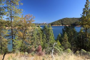
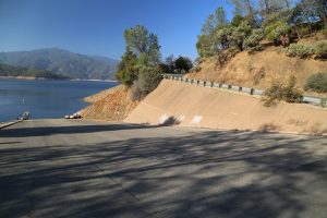
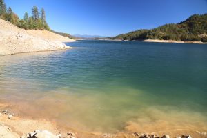
is located about 10 miles north of downtown Redding. Shasta Dam is still one of the country’s highest dams and is an extremely important body of water for much of the Central Valley to the south. When the lake is full, the water backs up some 35 miles. Several years ago during the drought years this lake was much lower then its current level and in fact, the boat launching facilities in some areas of the lake were a quarter of a mile or more from the high water line. However, due to the recent El Nino rains the water level has risen substantially and now is at normal levels.
The lake features some 370 miles of shoreline and is really spread out with numerous sections. Water temperatures in the summer average in the 70’s and 80’s and make for a pleasant dip especially when the air temperate is well over 100 degrees Fahrenheit.
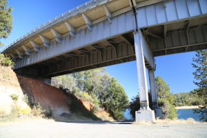
For those looking for quick access to the lake without a bunch of people around – take the Turntable Road exit just slightly north of where the 5 freeway crosses one arm of the lake. This road becomes dirt and eventually reaches the shadow of the bridge – but along the way there are several dirt pullouts where one can park and make the steep trek down to the water’s edge.
Shasta Dam
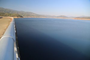
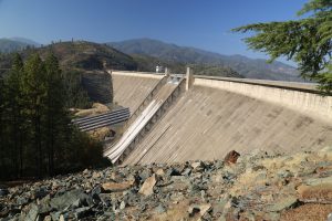
is located on the southernmost part of Lake Shasta. At 602 feet tall, this is one of the tallest dams in the United States. To reach the dam, take the 5 freeway to the appropriately named Shasta Dam Blvd – about a 10 minute drive from the freeway through the town of Shasta Lake to the actual dam. Along the way as you approach the lake there are several scenic viewpoints overlooking the dam. Once you reach the dam, pull into the sizable parking lot and enter the visitor center.
The visitor center is free to enter and contains informative displays about the dam and the lake including the 10 years of construction (culminating with the lake being filled in 1948). Also check out the 30 minute film showing the history of water usage in California. One hour tours of the dam are given year round (limited to the first 40 people who show up), although the hours vary and it would be wise to call ahead for a schedule of tours. The visitor center is open Monday through Friday from 8:30 until 4, and then on Saturday and Sunday from 8:30am until 5pm. Picnic tables are located outside on the grassy area; visitors are welcome to use these.
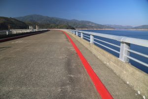
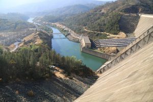
Continue through the visitor center to the path that leads to the top of the dam. Access is free. Scared of heights? You probably don’t want to look down on the south side! Rather focus your eyes on the lakeside.
Once you are ready to leave you can loop around back to Shasta Lake City – by taking Lake Blvd.
House boats
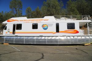
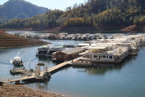
Shasta is also a great place for house boat cruising. There are several locations for renting house boats including the Shasta Marina at Packers Bay located along the shoreline – accessed via Packers Bay Road off of the southbound 5 freeway (from the exit takes about 10 minutes to wind down the narrow road before reaching the shoreline). This full service marina offers gas, ice and a small store where one can purchase Shasta souvenirs. They also rent wake boards, kayaks and provide provisions for fishing. They offer a launch ramp for their own houseboats and also a pull in spot for smaller boats.
For a more comprehensive experience and certainly one of the most popular spots on the lake – including on shore lodging, food, a wide variety of water sports and plenty of house boat rentals, check out Bridge Bay at Shasta Lake (we have toured the facilities here before).
On several occasions we have had to help other people pry their houseboat off of a sandbar or a mud bank. This usually seemed to happen after the “captain” of his “ship” had a little too much to drink. Another activity we enjoy, is watching people dive off of the second floor of their houseboat. Many families rent houseboats year after year. As Merle Haggard sings of his own Shasta memories….”like the winter we spent on Lake Shasta”, this lake holds many memories for people both in the wintertime and in the summertime.
As with most lakes water skiing in the early morning is the best. There are several coves in Lake Shasta that provide glass or mirror like conditions in the early morning.
Shasta Mud
An unpleasant experience is experiencing the gooey bottom that often lines the shores of Lake Shasta. After a long day or after several hours boating on the lake, we like to pull our boat into one of the many coves and drop anchor. We then jump overboard and swim to shore for a little rest and relaxation. However, in just about all the coves that we have visited we have found extremely deep mud at the shoreline of the coves.
This can be quite unnerving, especially when we sink up to mid chest in the mud on the edge of the steep shoreline.
Fishing
Lake Shasta fishing can be very rewarding. There are trout, bass, and catfish among other species. Trolling for trout is an extremely relaxing way to experience Lake Shasta.
Shasta Caverns
Visitor’s begin their journey to the spectacular caverns with a 15-minute catamaran ride across one of the arms of Lake Shasta to an awaiting 30-passenger bus which whisks you high above the shoreline to the entrance of the cave.
More information coming by the end of 2018.
WHISKEYTOWN LAKE
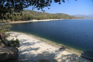
Whiskeytown Lake and recreation area is located about 8 miles east on Highway 299 from downtown Redding. As you drive east on 299 toward Whiskeytown Lake you will drive up a long hill. At the top is a road leading to the left, that winds by the visitor center.
Part of the lake is situated over the old gold mining town of the same name. Gold panning is allowed in the recreation area but only with a permit purchased from the Visitor Center. The visitor center is open from 9 to 5 during the summer months and the hours vary during the rest of the year. A number of local creeks are located in the area where you can find some small pieces of gold (best done in the winter or spring months when water is flowing).
Visitor’s to the park must purchase an entry pass either at this visitors center or online.
The lake is an ideal spot for water skiing or boating.
Bears can be seen in the hills near Whiskeytown. The largest bear paw print that we have ever seen in California was found near the north shoreline of the lake.
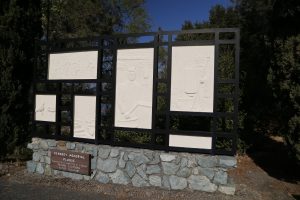
One item of historical interest is the memorial to John F. Kennedy located on western side of the lake. President Kennedy visited the lake in early Fall 1963 for it’s dedication. He later visited Mt. Lassen National Park. A speaker box is located in front of the memorial – press the button to hear experts from Kennedy’s speech (although note that the last few times we have visited this memorial, the speaker has been broken).
The concrete overflow structure located near the memorial is called the Glory Hole. It resembles a giant hole in the lake – although rarely used, it’s importance is significant when the lake reaches a certain level – then the water simply flows into this hole and is released into Clear Creek far below.
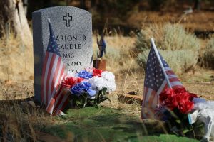
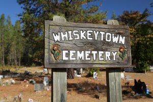
One can drive across the dam – there are several bathrooms and access to the shoreline on the other side. If you do not drive across the dam but rather take the road leading down the hill (across from the Kennedy Memorial) – you will soon reach the old Whiskeytown Cemetery. When the lake was built, it flooded out the old town of Whiskeytown and the cemetery was moved to it’s current location. Today a number of colorful decorations are still placed on the grave sites (and new graves continue to be added).
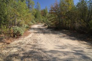
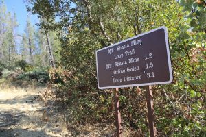
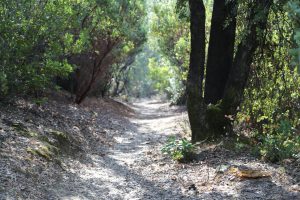
Continuing past the cemetery you will soon reach a rather sizable dirt parking lot on your left. This is the trail head for the Mt. Shasta Mine trail (a loop that is about 3 miles). Hikers, bikers and horse rides often use the trails here. Continuing past this parking lot – the road eventually turns to dirt sand leads to a number of other great trails including Prospect Trail and Mule Mountain Pass.










Leave a Reply