CONVICT LAKE
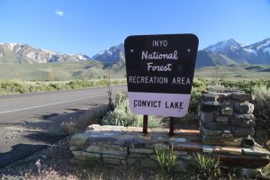
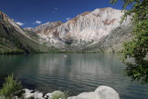
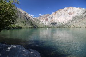
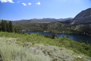
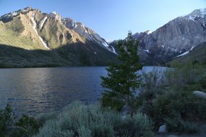 Located only about 20 minutes from Mammoth Lakes, Convict Lake is ‘hidden’ from view from Highway 395 yet is only 2 miles from this highway. Nestled at the base of dramatic mountains – popular for it’s scenic vistas and and fish (well-stocked to keep up with the demand of fisherman). Produces some large Rainbow trout – two annual fishing derbies are held – “Round Up at the Lake” in spring and “Ambush at the Lake” in fall.The lake was named after convicts who made their way here in 1871 after escaping from a prison in Carson City.
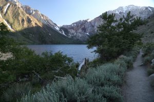
A narrow dirt trail leads around the entire lake offering up always changing vistas of the mountains and waters. Popular with fisherman. Also home to the Convict Lake Resort – featuring a variety of cabins (from basic to more luxury) and The Restaurant at Convict Lake.
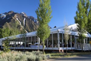
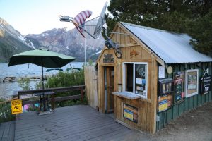
The resort also holds weddings and receptions – one of California’s most special places for getting married based on the jaw dropping surroundings. Those interested in horse riding can do so here as well – a General Store on site sells provisions as well as what some people might consider the most important item when visiting the lake, fishing licenses.
CROWLEY LAKE
Long known for superb fishing including trophy size fish – this lake is a common destination for fishermen, especially those who live in Southern California. The most popular destination on the lake is the Crowly Lake Fisherman Camp. The camp offers a significant variety of services – both to fisherman and for those just wanting to spend some time relaxing.
They have a full service marina including boat launching facilities, a general store, camp sites, RV hookups and cabins for rent. In addition to fishing other water related activities offered include kayaking, water skiing, wake boarding, wake surfing, kite surfing, and stand up paddle boarding. Visitor’s to the camp will stop at the entrance booth to check in and or pay for services.
The lake itself is a reservoir collecting water from the runoff from the nearby mountains (built in 1941). Sizable compared to some of the other nearby natural lakes – when full Crowley Lake is approximately 12 miles long and 5 miles wide.
GEM LAKES
Stunning. Accessible. High. Located along a trail from what is the highest trail head in all of California – beginning at 10,250 feet. One of the highest paved roads in the Sierra Nevada. Located about a 40 minute drive south of Mammoth – via Toms Place (not to be confused with the Gem Lake near June Lake). Several parking lots are located near the Little Lakes Valley Trailhead – but on busy summer and even weekdays both can be filled up. A very popular hiking spot. Best to get here early if you are visiting during these times. The nearby Mosquito Flats offers a walk-in campground.
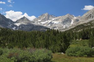
Despite the altitude (not recommended to come straight here from sea level unless you know you do well at elevation), the trail to a series of lakes is fairly gradual although rocky. Known locally as the Necklace Lakes each lake is located a short distance from the other – the first lake is only about 1/2 a mile in on the trail. Very scenic spot with views of the high Sierra Mountains to the west – plenty of water up here and Spring time comes in July with a number of prettty wildflowers (because of the high elevation). Hardy souls can brave the bracingly cold lake water for a refreshing swim. Mosquitos can be bad in this area in June.
The Rock Creek Lake Resort is located within a short drive of the trailhead and offers cabins, a general store and a small restaurant (certainly one of the highest restaurants in the entire state of California!).
JUNE LAKE
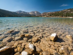 You enter the June Lake Loop from the 395 just south of Lee Vining or about 12 miles south at the southern entrance. We prefer entering at the southern entrance and looping around and coming out on 395 in the north. The loop leads you past (in this order) June Lake, Gull Lake, Silver Lake, and Grant Lake. In the winter these lakes are frozen over. In the summer they are a wonderful attraction for fishing, boating, and swimming.
When you first get a glimpse of June Lake from the southern part of the loop you will see a wooden vista tower on your right side. You too can carve your initials in the wood like hundreds before you. We recommend stopping and climbing up this little vista structure. You will have great views of the entire June Lake Basin and the towering mountains that surround it.
June Lake offers a more relaxed vibe and is a smaller town then Mammoth Lakes.
When you are in June Lake visit The Tree Wizard Gallery – artist Gary Burns is the “wiz”! Gary is a self taught carver and he can be found daily working in his studio which is part of the gallery. The “wiz” says that “each piece of wood has its own personality.” He “strives to flow with what each piece of wood has to offer, for the wood knows best what it will be best made into.” Gary’s gallery is on the left side of the street as you drive west through town. The gallery contains numerous wood elves and other wood carvings. Phone (760) 648-7642.
A few miles from the June Lake loop is a road that leads to the west off of the 395 called Glass Flow Road. This is a safe dirt road for cars in the summer months. It leads through a undisturbed Jeffrey Pine forest to the base of seemingly millions of large pieces of obsidian rocks stacked on one another. It rises about a 100 feet and extends for many more than that. This pile of obsidian rock is similar to the formation in Lassen National Park near Cinder Cone. This is a great place to get away during the summer and fall months. It is extremely quiet here and on a warm day it is an ideal place to read a good book.
MAMMOTH LAKES BASIN

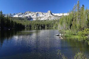 With a captivating beauty that is intense to behold, no trip to Mammoth Lakes is complete without spending some quality time here. Located within a short drive of Mammoth Lakes, this region features some 12 small lakes (all extremely picturesque) and some 50 miles of hiking trails. A biking/hiking path leads from Mammoth Lakes and runs next to a number of the lakes in the area. Access from Mammoth Lakes is from either Old Mammoth Road or Lake Mary Road. Alternatively visitors may take the Orange Line trolley and bring their bikes (this trolley comes with a bike trailer).
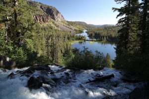
Highlights include the Twin Falls Overlook – which when full is a spectacular site – rushing water cascading down steep cliffs before reaching several lakes far below. Views from the overlook are impressive enough – but the more adventurous visitor may want to carefully descend the steep rocky trail that parallels the actual falls for more intimate views.
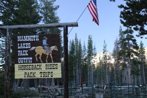
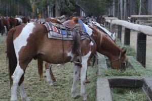
The Mammoth Lakes Pack Outfit is located along Old Mary Road; they offer both day horse rides and horses for longer back country excursions. Customized trips can also be arranged.
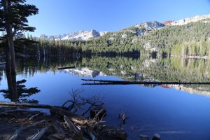
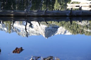
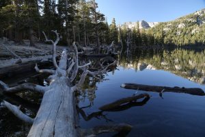
The morning summer silence is complemented by the stillness on Horseshoe Lake. Its reflective prowess draws your immediate glance upon arrival and its hypnotic beauty continues to command your attention. Is this a mirror you are looking at? At times like this – as you stare into the water, mesmerized, nature’s perfect reflection remains so – broken only by the hungry trout rippling the water’s surface.
Note the dead trees near the shoreline of Horseshoe Lake – these weren’t burned in a forest fire but rather succumbed to carbon monoxide poisoning seeping out of the ground.
For a rare look back into time into one of California’s gold mines consider a hike to the Consolidated Gold Mine (a 3.2 mile hike accessible from the day parking lot at the Coldwater Campground). An intimate peek into a mining site that still contains mining equipment and wooden structures (dates from the late 1920’s and early 1930’s).
Our video of Twin Falls, late July
MONO LAKE
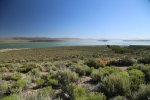
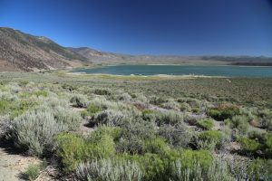
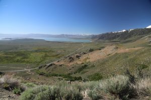 If Tahoe is the gem of the Western Sierras then Mono Lake is the jewel of the Eastern Sierras. Every year since the mid 90’s the lake has been slowly refilling. The reason for this is that restrictions were put into effect for water usage. Mono Lake is over 700,000 years old.
An interesting geological note is that the mountains just north of Mono Lake are about 11 million years old. However, the Mono Craters, which lie just to the south are the youngest mountain range in North America. Part of this mountain range formed from craters erupting as little as 600 years ago.
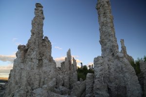
Mono Lake is a salt lake. It is too concentrated for fish, but there are millions of brine shrimp that live in its waters. Mono Lake is also known for its spectacular tufa formations, spires of rock that formed from deposits of calcium carbonate.
As the lake level climbs, the tufa will slowly be consumed by the waters of Mono Lake. The best place to see tufa is from the trail at South Tufa, located on the southern part of the lake. There is a turnoff for this trailhead from the 395. As you walk this trailhead pay attention to the signs indicated where the lake levels were between the 1940’s and 70’s. You will see that the lake was substantially higher then, and as a result, all the tufa would have been covered by water.
One neat phenomenon is the millions of flies that gather around the water’s edge. Sometimes there are so many that the edge is literally black with flies. I have watched birds walk along trying to peck at the flies, and there are huge clouds of black that arise in front of the bird.
At sunset this is a beautiful location for photography. Often you will see photographers huddled next to the water’s edge.
MONO LAKE TUFA STATE NATURAL RESERVE
This State Natural Reserve is an ideal place to take photographs of photographers especially in dawns early light or or the fading light prior to nature’s impending darkness every evening. Mono Lake is known for prolific bird life, but the reason for the flocking of the photographers to this part of the lake is to capture the changing light over the strange yet awe inspiring “tufa towers. These are mostly whitish calcium-carbonate spires and and unique formations formed from the interaction of the alkaline lake waters with fresh water flowing down from the nearby mountains.
A sizable parking lot is located next to the loop trailhead to the tufa towers (raised boardwalk). Parking is free – although note that one side of the parking lot is reserved for those who have California State Parks passes. The hike down to the edge of the lake where the tufa towers are located takes about 10 minutes.
MONO LAKE VISITORS CENTER
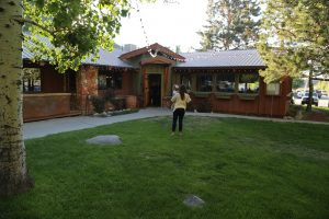
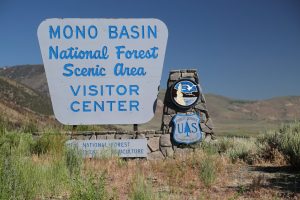
is located 1 mile north of Lee Vining. This is a great place to enjoy panoramic views of the lake. The visitor centers contains a small museum (free but donations are welcome) and a gift shop with Mono Lake collectables, maps and guides. Be sure to look up at the many mud swallow nests on the outside of the visitor center facing the lake. Mono Lake is the home to millions of migratory birds.
The visitor center is open 9am to 5pm April 1 through Labor Day and from 9am to 4pm the rest of the year.
For those driving along the western side of the lake on Highway 395, look for an exit to a grassy park on Mono Lake’s northern side (simply called Mono Lake Park). A small paved road leads down to the lake (a very short drive from the highway). This park has a boardwalk which you can walk to the shores of Mono Lake, but access is restricted to only the boardwalk. Great site for a picnic on a warm spring or summer day.
The essential must visit site about Mono Lake is: www.monolake.org











Leave a Reply